MyTopo
Glen Rose West Texas US Topo Map
Couldn't load pickup availability
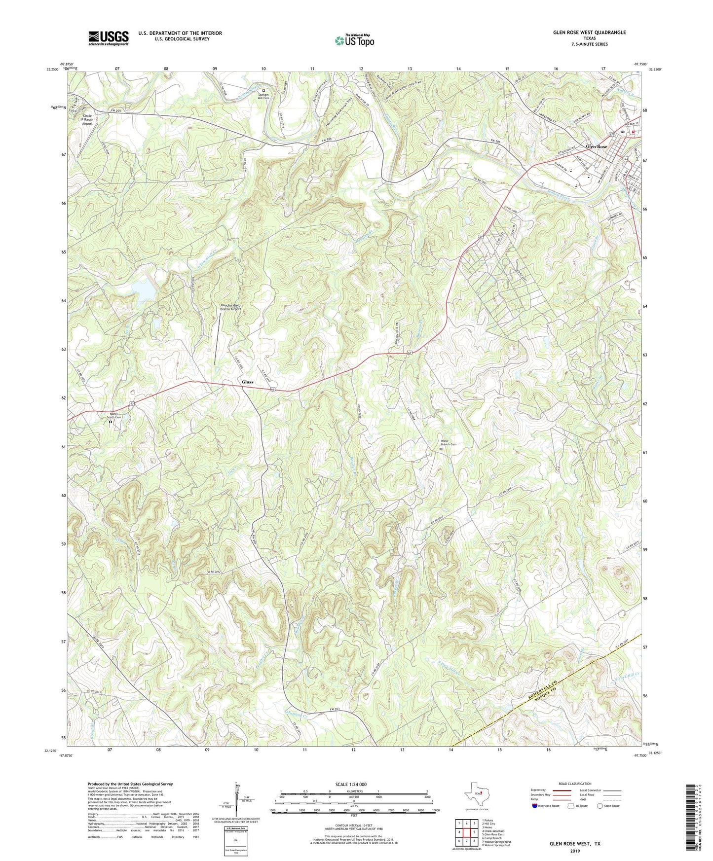
2022 topographic map quadrangle Glen Rose West in the state of Texas. Scale: 1:24000. Based on the newly updated USGS 7.5' US Topo map series, this map is in the following counties: Somervell, Bosque. The map contains contour data, water features, and other items you are used to seeing on USGS maps, but also has updated roads and other features. This is the next generation of topographic maps. Printed on high-quality waterproof paper with UV fade-resistant inks.
Quads adjacent to this one:
West: Chalk Mountain
Northwest: Paluxy
North: Hill City
Northeast: Nemo
East: Glen Rose East
Southeast: Walnut Springs East
South: Walnut Springs West
Southwest: Camp Branch
This map covers the same area as the classic USGS quad with code o32097b7.
Contains the following named places: Barker Branch, Barnards Mill, Bowden Branch, Circle P Ranch Airport, Cross Branch, Dinosaur Valley State Park, Fossil Rim Wildlife Center, Glass, Glen Rose, Glen Rose City Hall, Glen Rose Division, Glen Rose Elementary School, Glen Rose High School, Glen Rose Intermediate School, Glen Rose Post Office, Ice Branch, Ice Creek, Lake Reed, Lanham Mill Cemetery, Montgomery Branch, Nancy Smith Cemetery, Oden Church, Panther Creek, Prairie Creek, Rancho Hielo Brazos Airport, Russell Lake, Russell Lake Dam, Saint Rose of Lima Catholic Church, Somervell County, Somervell County Constable's Office Precincts 1 and 2, Somervell County Fire Department, Somervell County Museum, Tiger Stadium, Ward Branch Cemetery, White Bluff Creek, Wright Ranch Airport, ZIP Code: 76043