MyTopo
Papalote Texas US Topo Map
Couldn't load pickup availability
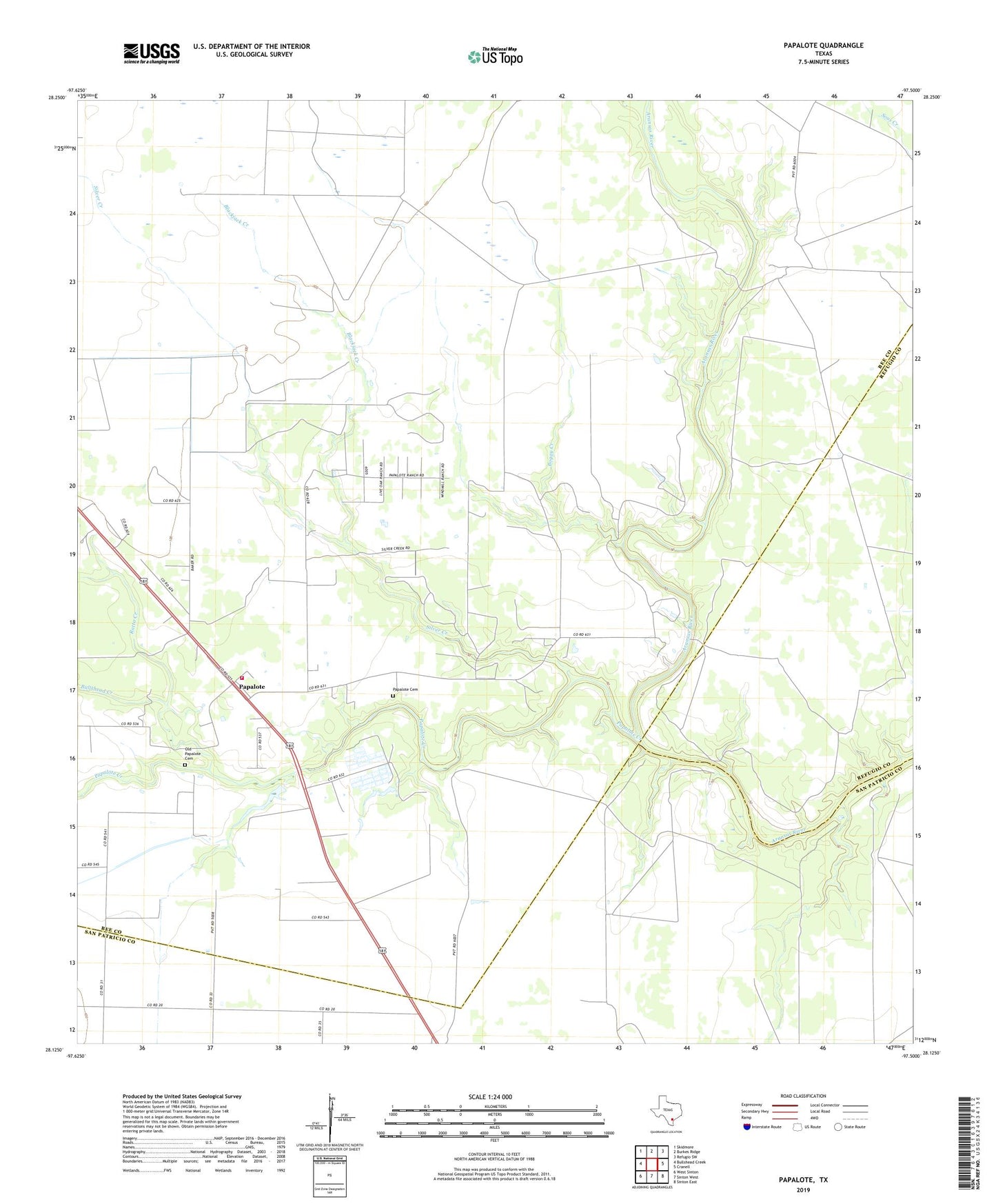
2022 topographic map quadrangle Papalote in the state of Texas. Scale: 1:24000. Based on the newly updated USGS 7.5' US Topo map series, this map is in the following counties: Bee, San Patricio, Refugio. The map contains contour data, water features, and other items you are used to seeing on USGS maps, but also has updated roads and other features. This is the next generation of topographic maps. Printed on high-quality waterproof paper with UV fade-resistant inks.
Quads adjacent to this one:
West: Bullshead Creek
Northwest: Skidmore
North: Burkes Ridge
Northeast: Refugio SW
East: Cranell
Southeast: Sinton East
South: Sinton West
Southwest: West Sinton
This map covers the same area as the classic USGS quad with code o28097b5.
Contains the following named places: Blackjack Creek, Boggy Creek, Bullshead Creek, Old Papalote Cemetery, Papalote, Papalote Cemetery, Papalote Creek, Papalote Oil Field, Papalote Volunteer Fire Department, Ratta Creek, Silver Creek