
MyTopo
Patterson Hills Texas US Topo Map
Couldn't load pickup availability
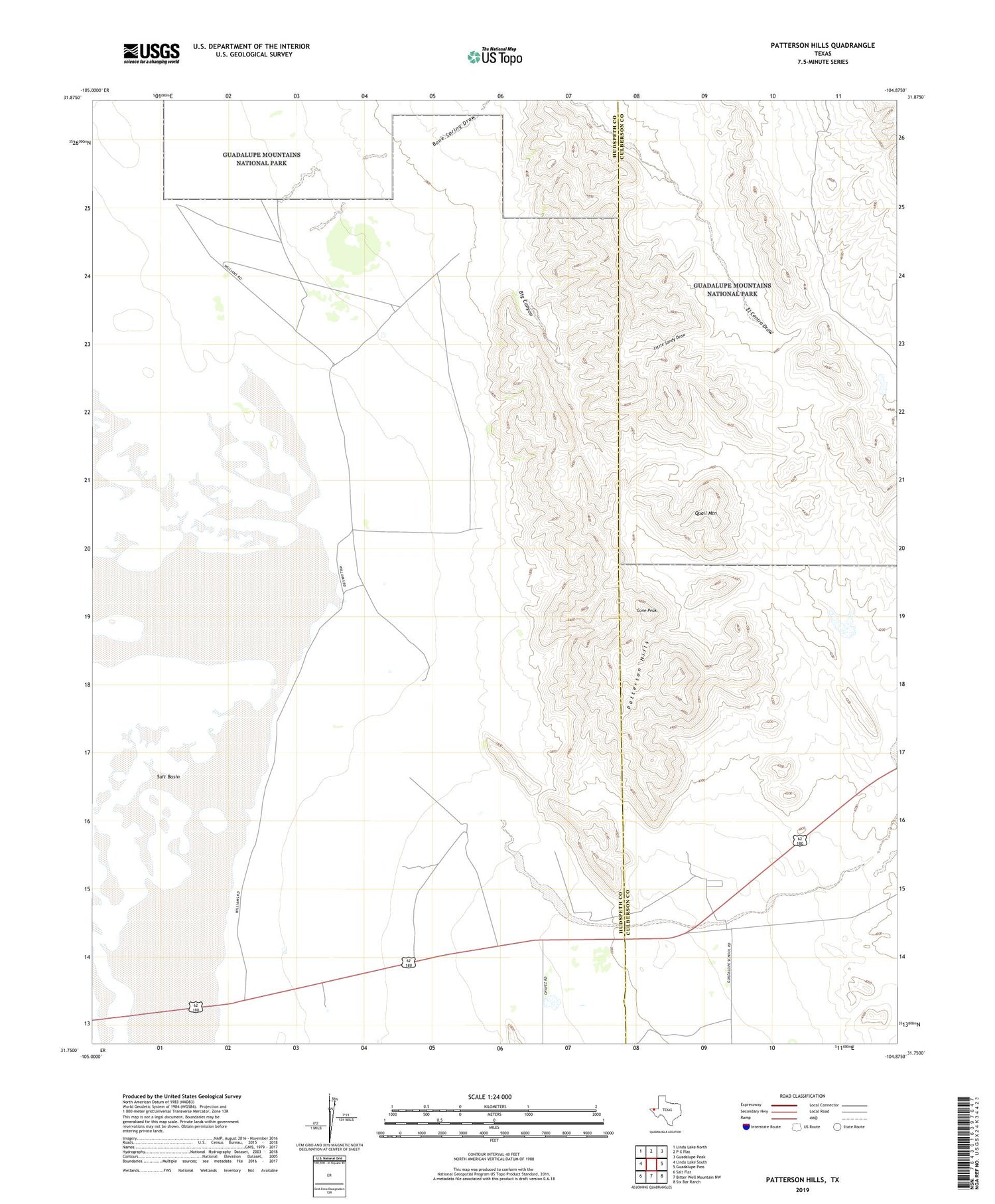
2019 topographic map quadrangle Patterson Hills in the state of Texas. Scale: 1:24000. Based on the newly updated USGS 7.5' US Topo map series, this map is in the following counties: Hudspeth, Culberson. The map contains contour data, water features, and other items you are used to seeing on USGS maps, but also has updated roads and other features. This is the next generation of topographic maps. Printed on high-quality waterproof paper with UV fade-resistant inks.
Quads adjacent to this one:
West: Linda Lake South
Northwest: Linda Lake North
North: P X Flat
Northeast: Guadalupe Peak
East: Guadalupe Pass
Southeast: Six Bar Ranch
South: Bitter Well Mountain NW
Southwest: Salt Flat
Contains the following named places: Big Canyon, Bone Spring Draw, Cone Peak, El Centro Draw, Guadalupe Arroyo, Guadalupe Pumping Station, Guadalupe School, Hammack Ranch Cemetery, Hammock Ranch, Little Sandy Draw, New Well, Patterson Hills, Quail Mountain


