MyTopo
P X Flat Texas US Topo Map
Couldn't load pickup availability
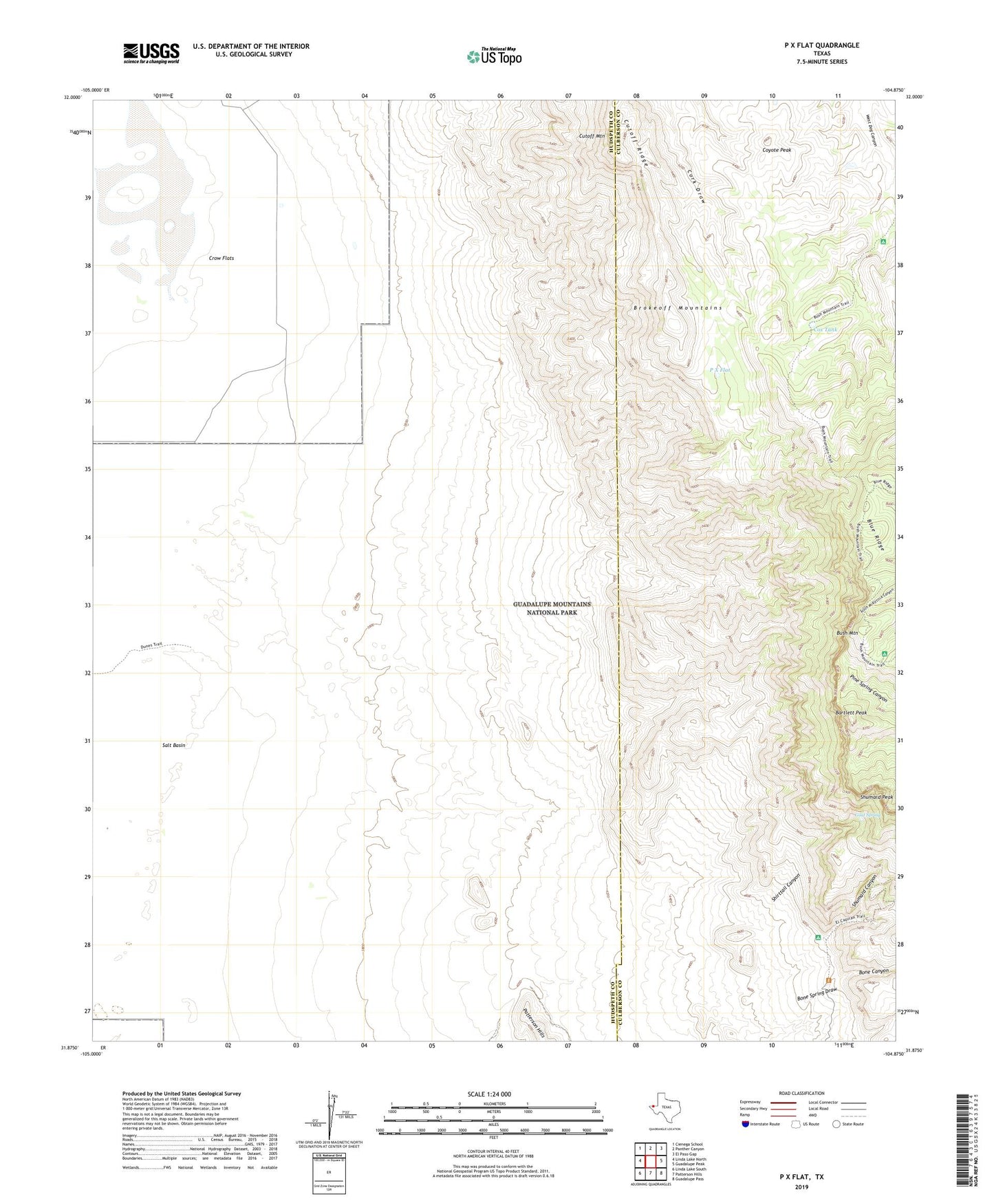
2022 topographic map quadrangle P X Flat in the state of Texas. Scale: 1:24000. Based on the newly updated USGS 7.5' US Topo map series, this map is in the following counties: Hudspeth, Culberson. The map contains contour data, water features, and other items you are used to seeing on USGS maps, but also has updated roads and other features. This is the next generation of topographic maps. Printed on high-quality waterproof paper with UV fade-resistant inks.
Quads adjacent to this one:
West: Linda Lake North
Northwest: Cienega School
North: Panther Canyon
Northeast: El Paso Gap
East: Guadalupe Peak
Southeast: Guadalupe Pass
South: Patterson Hills
Southwest: Linda Lake South
This map covers the same area as the classic USGS quad with code o31104h8.
Contains the following named places: Ables Well, Bartlett Peak, Blue Ridge, Bone Canyon, Bush Mountain, Bush Mountain Trail, Cox Tank, Coyote Peak, Cutoff Mountain, Cutoff Ridge, Eclipse Well, Goat Spring, Guadalupe Mountains National Park, Kincaid Trail, Lewis Well, P X Flat, Pure Well, Shirttail Canyon, Shumard Canyon, Williams Ranch