MyTopo
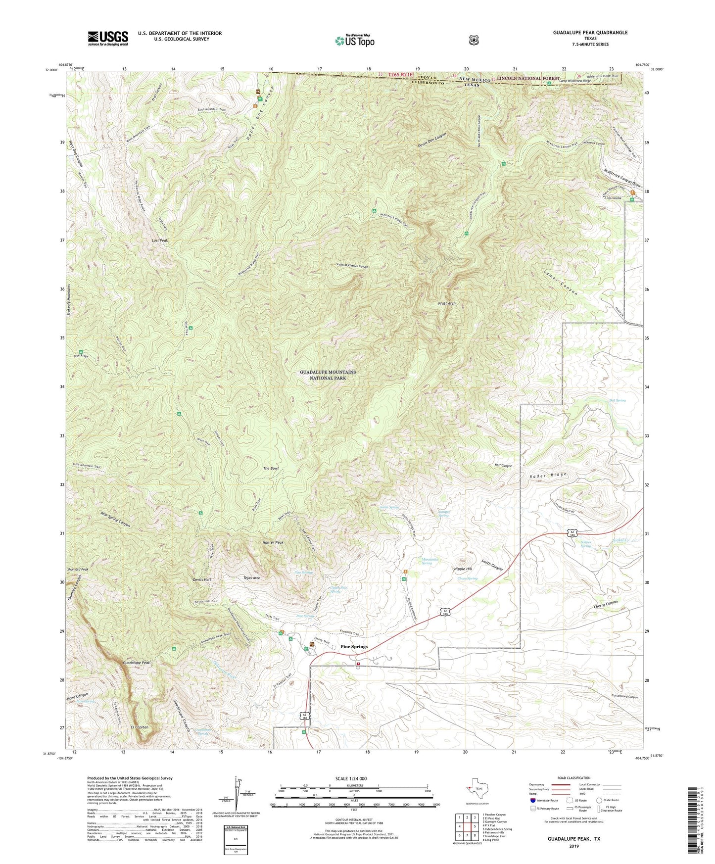
Guadalupe Peak Texas US Topo Map
Couldn't load pickup availability
Also explore the Guadalupe Peak Forest Service Topo of this same quad for updated USFS data
2022 topographic map quadrangle Guadalupe Peak in the state of Texas. Scale: 1:24000. Based on the newly updated USGS 7.5' US Topo map series, this map is in the following counties: Culberson. The map contains contour data, water features, and other items you are used to seeing on USGS maps, but also has updated roads and other features. This is the next generation of topographic maps. Printed on high-quality waterproof paper with UV fade-resistant inks.
Quads adjacent to this one:
West: P X Flat
Northwest: Panther Canyon
North: El Paso Gap
Northeast: Gunsight Canyon
East: Independence Spring
Southeast: Long Point
South: Guadalupe Pass
Southwest: Patterson Hills
This map covers the same area as the classic USGS quad with code o31104h7.
Contains the following named places: Bell Spring, Bone Spring, Bowl Trail, Choza Spring, Devils Den Canyon, Devils Hall, Dog Canyon Ranger Station, El Capitan, Frijole, Frijole Ranch, Guadalupe Mountains, Guadalupe Mountains National Park Fire Department, Guadalupe Mountains Wilderness, Guadalupe Peak, Guadalupe Ranch, Guadalupe Spring, Hunter Peak, Juniper Spring, Ligon Ranch, Lost Peak, Manzanita Spring, Marcus Trail, McKittrick Canyon, Nipple Hill, North McKittrick Canyon, Pine Spring, Pine Spring Campground, Pine Spring Canyon, Pine Springs, Pinery, Pinery Station, Pratt Arch, Rader Ridge, Shumard Peak, Smith Canyon, Smith Spring, Soldier Spring, South McKittrick Canyon, Tejas Arch, Tejas Trail, The Bowl, Upper Pine Spring, Wallace Pratt Lodge, Wilderness Ridge - Shumard Trail