MyTopo
Pecos East Texas US Topo Map
Couldn't load pickup availability
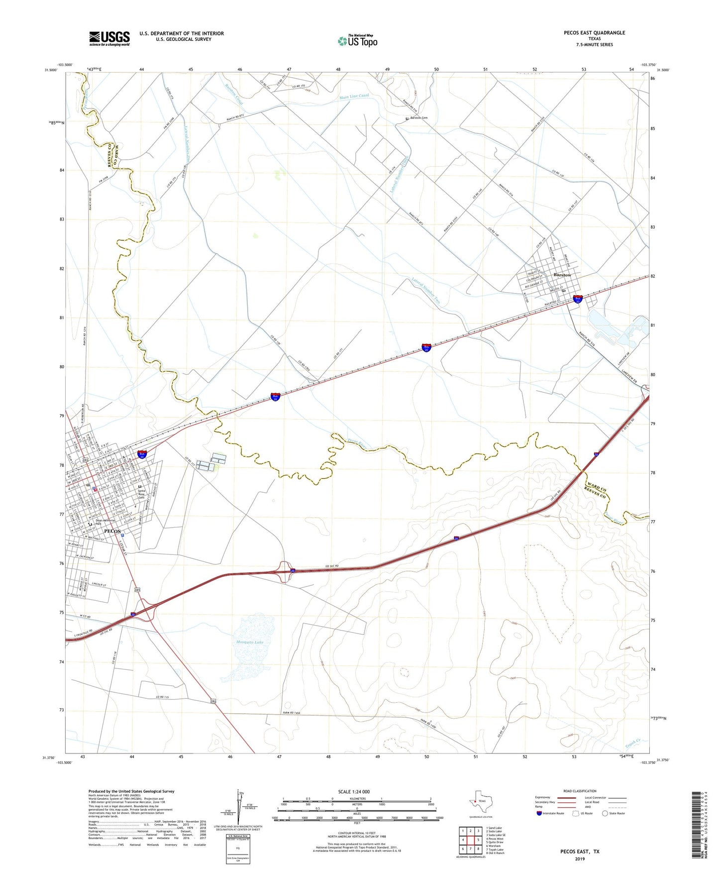
2022 topographic map quadrangle Pecos East in the state of Texas. Scale: 1:24000. Based on the newly updated USGS 7.5' US Topo map series, this map is in the following counties: Reeves, Ward. The map contains contour data, water features, and other items you are used to seeing on USGS maps, but also has updated roads and other features. This is the next generation of topographic maps. Printed on high-quality waterproof paper with UV fade-resistant inks.
Quads adjacent to this one:
West: Pecos West
Northwest: Sand Lake
North: Soda Lake
Northeast: Soda Lake SE
East: Quito Draw
Southeast: Old X Ranch
South: Toyah Lake
Southwest: Worsham
This map covers the same area as the classic USGS quad with code o31103d4.
Contains the following named places: Barstow, Barstow Cemetery, Barstow Post Office, Bessie Haynes Elementary School, Bessie Haynes Park, City of Barstow, De Zavala Middle School, Dean Memorial Park, Earl Bell School, East Pecos Junior High School, Elm Street Church, Emmanuel Assembly of God Church, Lateral Number One, Lateral Number Three, Lateral Number Two, Main Line Canal, Mosquito Lake, Mount Zion Church, New Life Baptist Church, North Temple Baptist Church, Old Pecos Cemetery, Pecos, Pecos City Hall, Pecos Elementary School, Pecos Post Office, Pecos School, Pecos Volunteer Ambulance Service, Pecos Volunteer Fire Department, Reeves County Jail, Reeves County Sheriff's Office, Reeves County Sheriff's Posse, Saint Catherines Church, Saint James Baptist Church, Santa Rosa Catholic Church, Santa Rosa Cemetery, Santa Rosa de Lima Church, Sullivan Bridge, United States Border Patrol Station, West of the Pecos Museum, ZIP Code: 79719