MyTopo
Petty Texas US Topo Map
Couldn't load pickup availability
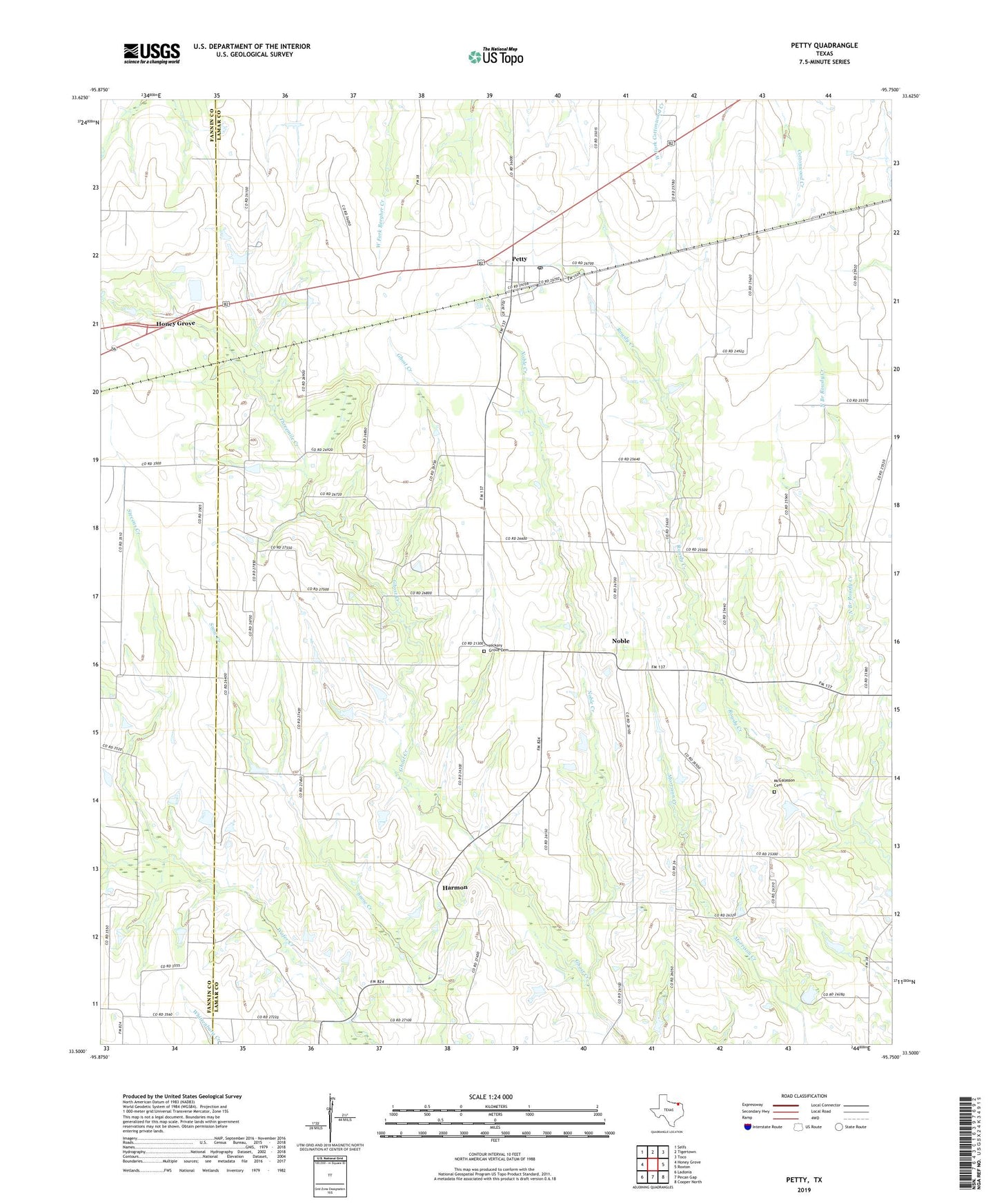
2019 topographic map quadrangle Petty in the state of Texas. Scale: 1:24000. Based on the newly updated USGS 7.5' US Topo map series, this map is in the following counties: Lamar, Fannin. The map contains contour data, water features, and other items you are used to seeing on USGS maps, but also has updated roads and other features. This is the next generation of topographic maps. Printed on high-quality waterproof paper with UV fade-resistant inks.
Quads adjacent to this one:
West: Honey Grove
Northwest: Selfs
North: Tigertown
Northeast: Toco
East: Roxton
Southeast: Cooper North
South: Pecan Gap
Southwest: Ladonia
Contains the following named places: El Bethel School, Ghost School, Grogens Lake, Grogens Lake Dam, Harmon, Harmon School, Hickory Grove Cemetery, Hills Chapel, McClelland School, McGalasson Cemetery, Mount Moriah Church, Noble, Noble Creek, North Branch Rowdy Creek, Paradise School, Petty, Petty Census Designated Place, Petty Post Office, Rock Hill School, Roxton Division, Stevens Creek, Swan Chapel, Threemile Creek, White Rock, White Rock Church, ZIP Code: 75470