
MyTopo
Pilot Knob Texas US Topo Map
Couldn't load pickup availability
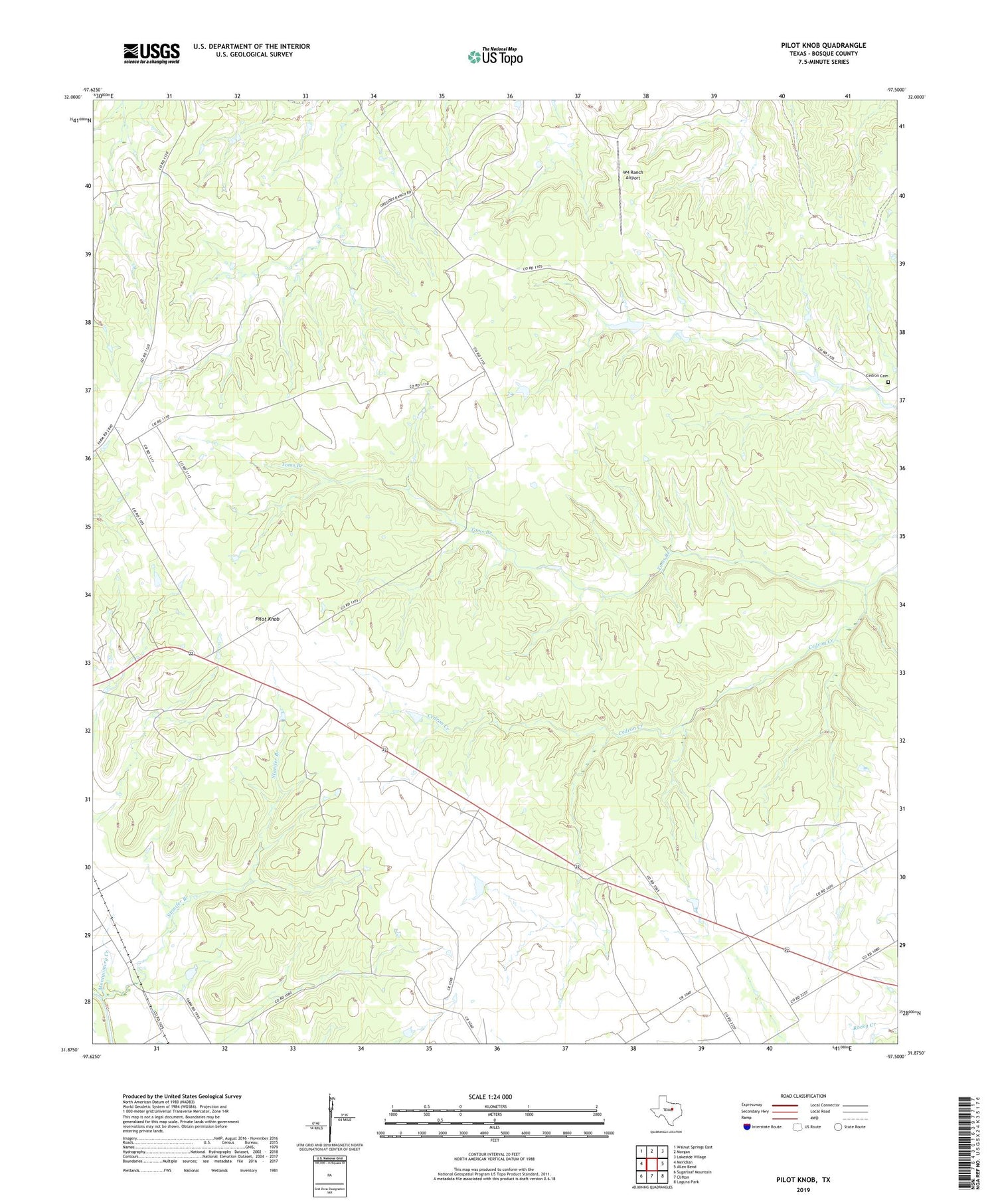
2019 topographic map quadrangle Pilot Knob in the state of Texas. Scale: 1:24000. Based on the newly updated USGS 7.5' US Topo map series, this map is in the following counties: Bosque. The map contains contour data, water features, and other items you are used to seeing on USGS maps, but also has updated roads and other features. This is the next generation of topographic maps. Printed on high-quality waterproof paper with UV fade-resistant inks.
Quads adjacent to this one:
West: Meridian
Northwest: Walnut Springs East
North: Morgan
Northeast: Lakeside Village
East: Allen Bend
Southeast: Laguna Park
South: Clifton
Southwest: Sugarloaf Mountain
Contains the following named places: Cedron Cemetery, Montgomery Creek, Pilot Knob, Stanifer Branch, Toms Branch, W4 Ranch Airport, ZIP Code: 76671


