MyTopo
Morgan Texas US Topo Map
Couldn't load pickup availability
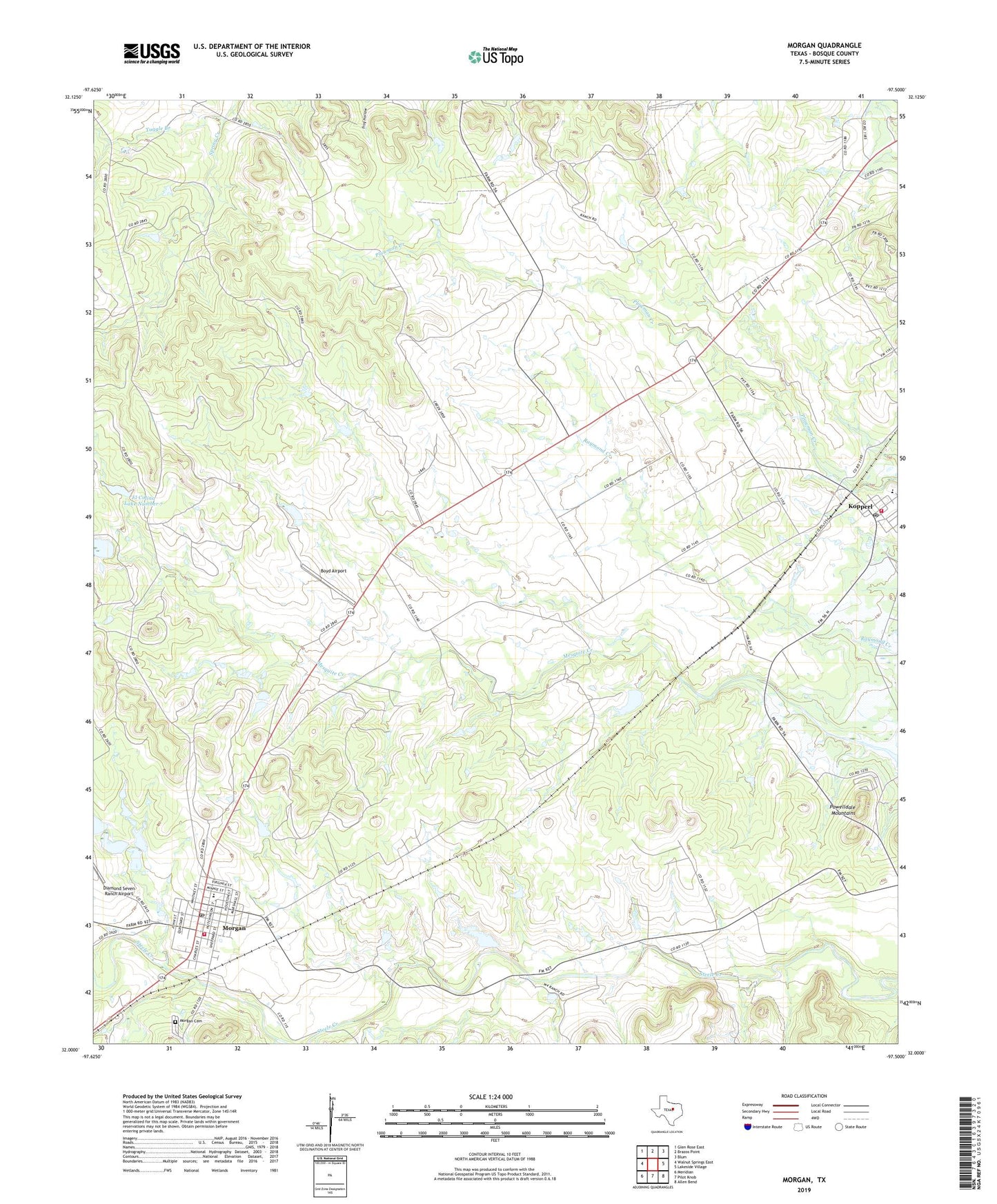
2022 topographic map quadrangle Morgan in the state of Texas. Scale: 1:24000. Based on the newly updated USGS 7.5' US Topo map series, this map is in the following counties: Bosque. The map contains contour data, water features, and other items you are used to seeing on USGS maps, but also has updated roads and other features. This is the next generation of topographic maps. Printed on high-quality waterproof paper with UV fade-resistant inks.
Quads adjacent to this one:
West: Walnut Springs East
Northwest: Glen Rose East
North: Brazos Point
Northeast: Blum
East: Lakeside Village
Southeast: Allen Bend
South: Pilot Knob
Southwest: Meridian
This map covers the same area as the classic USGS quad with code o32097a5.
Contains the following named places: Boyd Airport, City of Morgan, Diamond Seven Ranch Airport, El Colina Lake Number 5, El Colina Lake Number 5 Dam, El Colina Lake Number 6, El Colina Lake Number 6 Dam, El Colina Lake Number 7, El Colina Lake Number 7 Dam, Kopperl, Kopperl Post Office, Kopperl Volunteer Fire Department, Morgan, Morgan Cemetery, Morgan Post Office, Morgan Volunteer Fire Department, Steele Creek, Tuggle Branch, ZIP Code: 76652