MyTopo
Pleasant Creek Texas US Topo Map
Couldn't load pickup availability
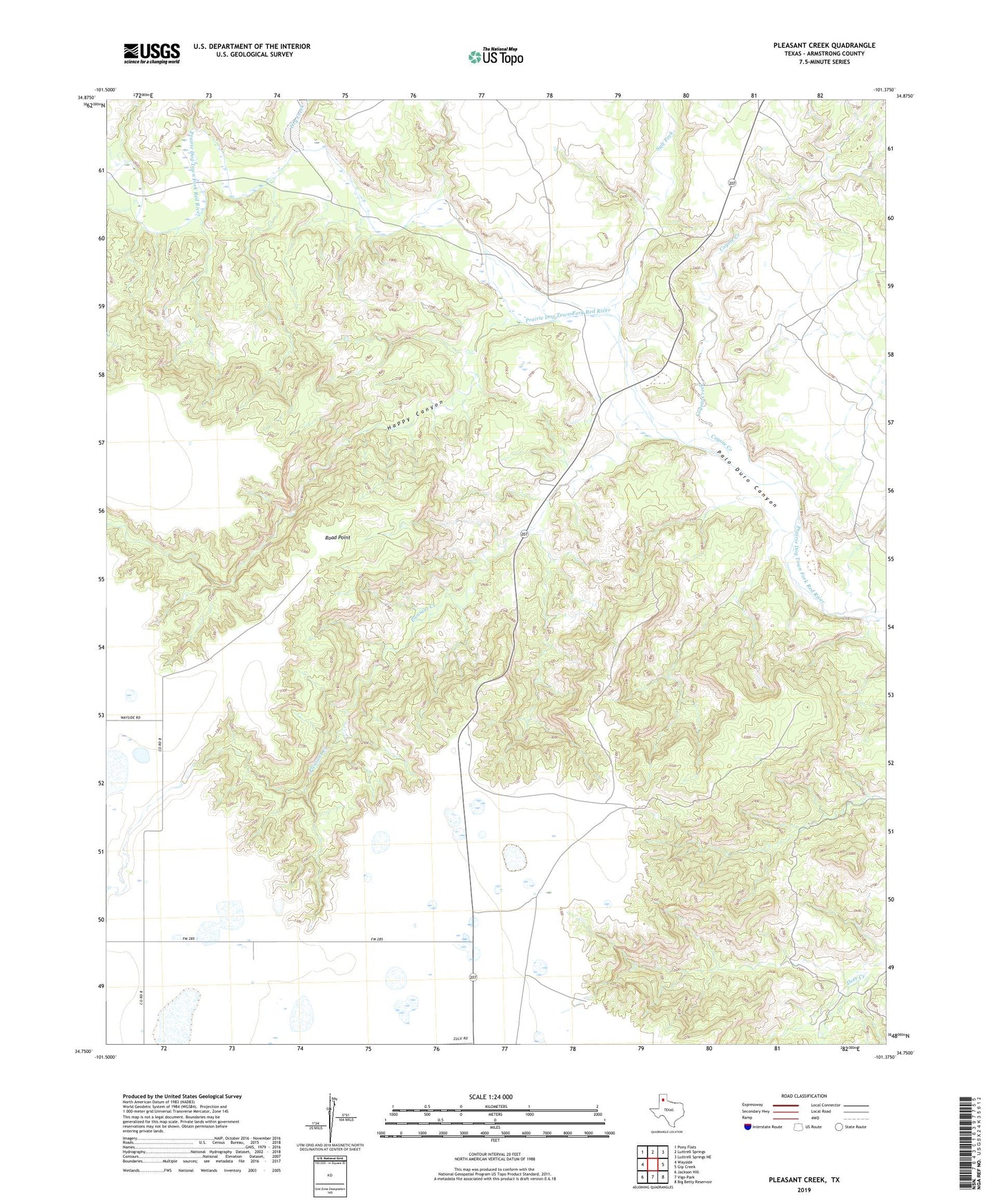
2022 topographic map quadrangle Pleasant Creek in the state of Texas. Scale: 1:24000. Based on the newly updated USGS 7.5' US Topo map series, this map is in the following counties: Armstrong. The map contains contour data, water features, and other items you are used to seeing on USGS maps, but also has updated roads and other features. This is the next generation of topographic maps. Printed on high-quality waterproof paper with UV fade-resistant inks.
Quads adjacent to this one:
West: Wayside
Northwest: Pony Flats
North: Luttrell Springs
Northeast: Luttrell Springs NE
East: Gip Creek
Southeast: Big Betty Reservoir
South: Vigo Park
Southwest: Jackson Hill
This map covers the same area as the classic USGS quad with code o34101g4.
Contains the following named places: Coyote Creek, Dry Creek, Happy Canyon, Pleasant Creek, Road Point, Salt Fork