MyTopo
Big Betty Reservoir Texas US Topo Map
Couldn't load pickup availability
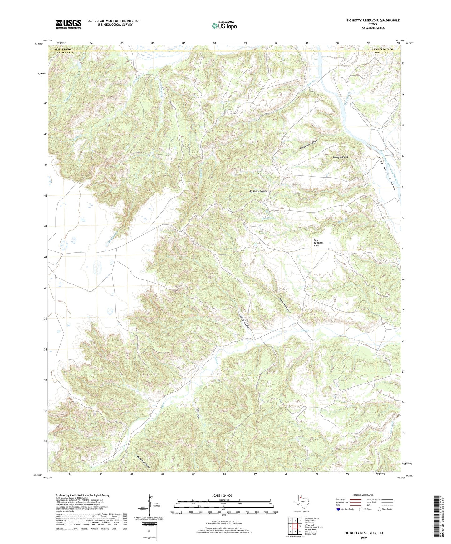
2022 topographic map quadrangle Big Betty Reservoir in the state of Texas. Scale: 1:24000. Based on the newly updated USGS 7.5' US Topo map series, this map is in the following counties: Briscoe, Armstrong. The map contains contour data, water features, and other items you are used to seeing on USGS maps, but also has updated roads and other features. This is the next generation of topographic maps. Printed on high-quality waterproof paper with UV fade-resistant inks.
Quads adjacent to this one:
West: Vigo Park
Northwest: Pleasant Creek
North: Gip Creek
Northeast: Paloduro
East: Hardscrabble Creek
Southeast: Indian Peak
South: Ross Canyon
Southwest: Cope Creek
This map covers the same area as the classic USGS quad with code o34101f3.
Contains the following named places: Bear Creek, Big Betty Canyon, Big Betty Reservoir, Blacktail Creek, Bull Run, Campbell Creek, Campbell Creek Camp, Cedar Creek, Cyclone Pens, Day Windmill, Day Windmill Flats, Eddies Pens, Goodnight Canyon, Horse Creek, Jersey Canyon, Little Tepee Pole Canyon, Lufberg Canyon, McMurtry Canyon, Pilgrim Creek, Soda Windmill, Tepee Pole Canyon, Tule Pens