MyTopo
Pluck Texas US Topo Map
Couldn't load pickup availability
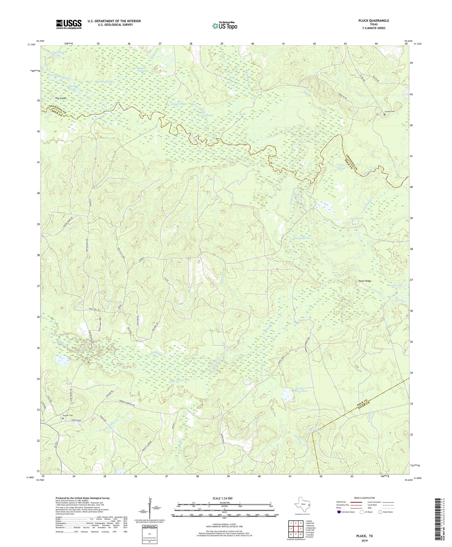
2019 topographic map quadrangle Pluck in the state of Texas. Scale: 1:24000. Based on the newly updated USGS 7.5' US Topo map series, this map is in the following counties: Polk, Angelina, Tyler. The map contains contour data, water features, and other items you are used to seeing on USGS maps, but also has updated roads and other features. This is the next generation of topographic maps. Printed on high-quality waterproof paper with UV fade-resistant inks.
Quads adjacent to this one:
West: Wakefield
Northwest: Diboll
North: Bald Hill
Northeast: Manning
East: Wolf Hill
Southeast: Chester
South: Camden
Southwest: Corrigan
Contains the following named places: Albritton Slough, Bear Creek, Big Branch, Cypress Lake, Deep Slough, Dollarhide Lake, Double Slough, Georges Creek, Georges Prairie Pond, Grimes Cemetery, Harris Spring, Howell Lake, Jones Branch, Lamar Slough, Lick Slough, Peach Ridge, Pluck, Prairie Creek, Rockfounder Branch, Sandy Branch, Saxon Branch, School Branch, Steep Hollow Branch, Stryker Cemetery, Sulphur Creek