MyTopo
Polar Texas US Topo Map
Couldn't load pickup availability
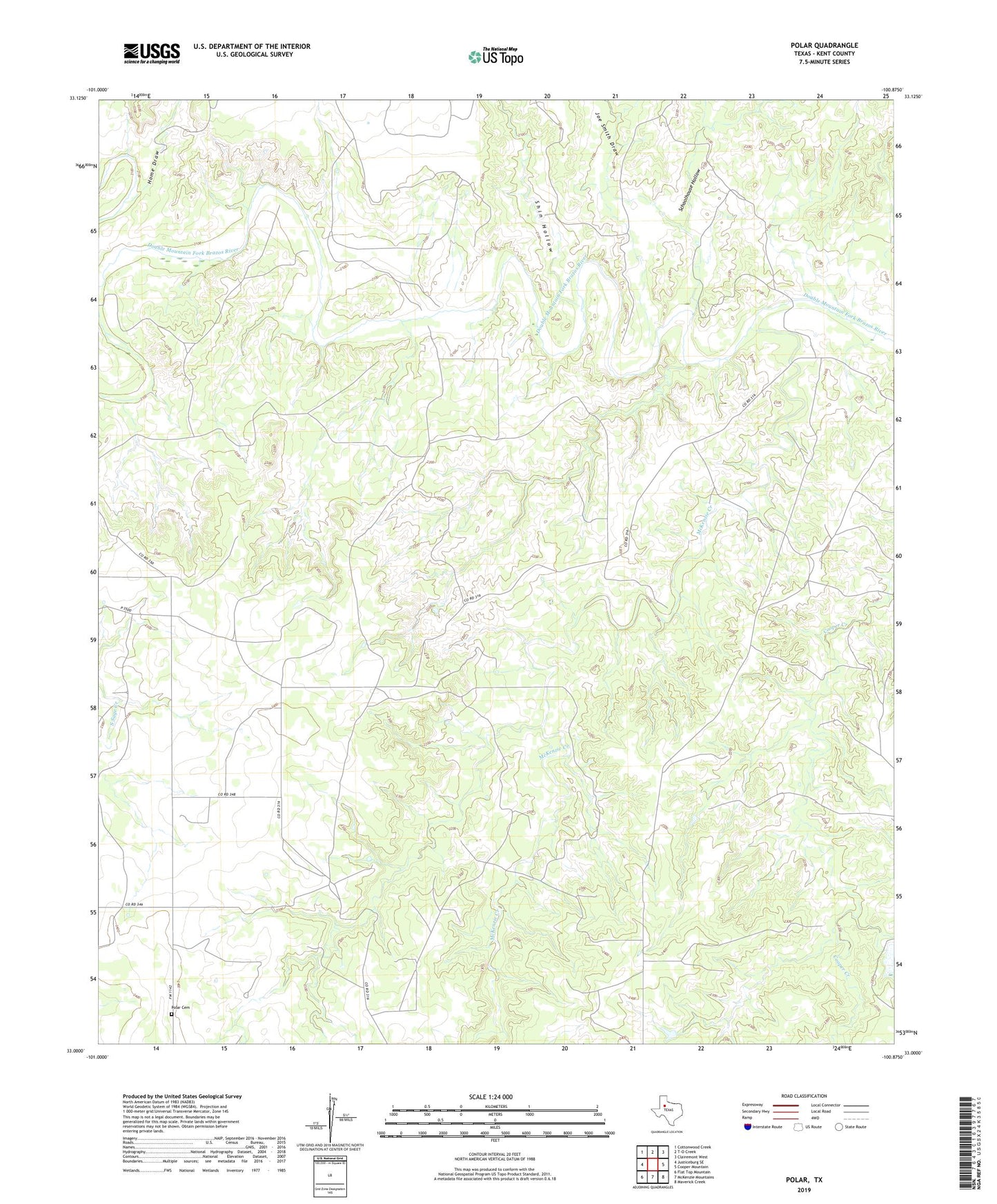
2022 topographic map quadrangle Polar in the state of Texas. Scale: 1:24000. Based on the newly updated USGS 7.5' US Topo map series, this map is in the following counties: Kent. The map contains contour data, water features, and other items you are used to seeing on USGS maps, but also has updated roads and other features. This is the next generation of topographic maps. Printed on high-quality waterproof paper with UV fade-resistant inks.
Quads adjacent to this one:
West: Justiceburg SE
Northwest: Cottonwood Creek
North: T-O Creek
Northeast: Clairemont West
East: Cooper Mountain
Southeast: Maverick Creek
South: McKenzie Mountains
Southwest: Flat Top Mountain
This map covers the same area as the classic USGS quad with code o33100a8.
Contains the following named places: Cogdell Ranch Lake Dam, Connell Ranch, Home Draw, Joe Smith Draw, McKenzie Creek, Polar, Polar Cemetery, Schoolhouse Hollow, Shin Hollow