MyTopo
Cottonwood Creek Texas US Topo Map
Couldn't load pickup availability
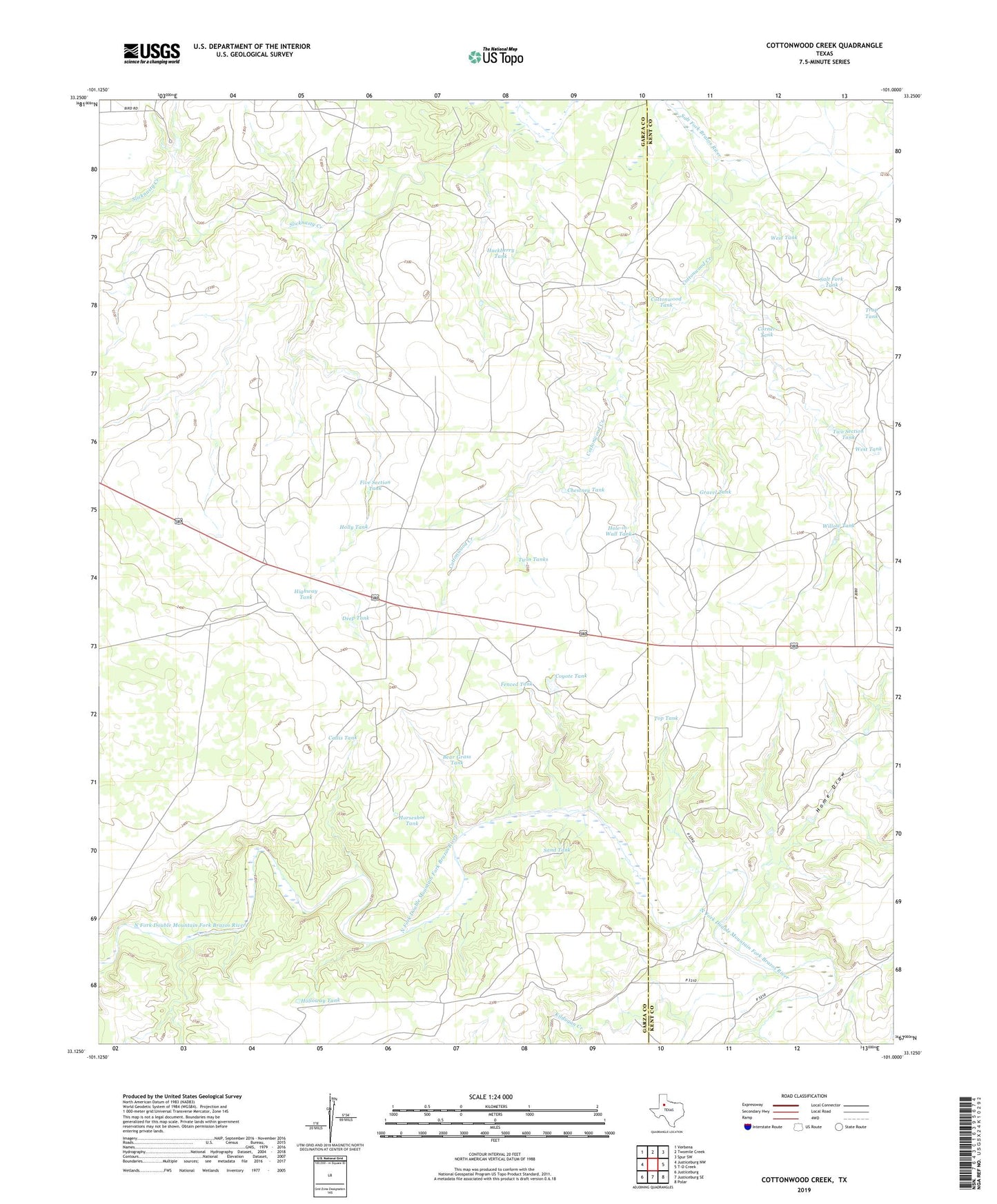
2022 topographic map quadrangle Cottonwood Creek in the state of Texas. Scale: 1:24000. Based on the newly updated USGS 7.5' US Topo map series, this map is in the following counties: Garza, Kent. The map contains contour data, water features, and other items you are used to seeing on USGS maps, but also has updated roads and other features. This is the next generation of topographic maps. Printed on high-quality waterproof paper with UV fade-resistant inks.
Quads adjacent to this one:
West: Justiceburg NW
Northwest: Verbena
North: Twomile Creek
Northeast: Spur SW
East: T-O Creek
Southeast: Polar
South: Justiceburg SE
Southwest: Justiceburg
This map covers the same area as the classic USGS quad with code o33101b1.
Contains the following named places: Bear Grass Tank, Beggs Ranch, Beggs Ranch Airport, Buzzard Windmill, Callis Tank, Callis Windmill, Chestney Tank, Corner Tank, Cottonwood Creek, Cottonwood Tank, Cottonwood Windmill, Coyote Tank, Coyote Windmill, Deep Tank, Fenced Tank, Five Section Tank, Gravel Tank, Hackberry Tank, Highway Tank, Hole-in-Wall Tank, Hole-in-Wall Windmill, Holloway Tank, Holly Tank, Holly Windmill, Home Draw, Horseshoe Tank, Horseshoe Windmill, Johnson Ranch, Kildugan Creek, Mare Windmill, Red Tank, Round Mountain Windmill, Salt Fork Tank, Sand Tank, Schoolhouse Windmill, Shinnery Windmill, Slicknasty Creek, Slicknasty Windmill, Top Tank, Trap Tank, Twin Tanks, Two Section Tank, West Tank, Willow Tank