MyTopo
Pollard Creek NW Texas US Topo Map
Couldn't load pickup availability
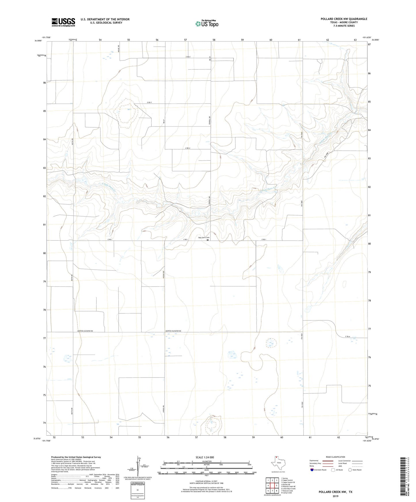
2022 topographic map quadrangle Pollard Creek NW in the state of Texas. Scale: 1:24000. Based on the newly updated USGS 7.5' US Topo map series, this map is in the following counties: Moore. The map contains contour data, water features, and other items you are used to seeing on USGS maps, but also has updated roads and other features. This is the next generation of topographic maps. Printed on high-quality waterproof paper with UV fade-resistant inks.
Quads adjacent to this one:
West: Dumas NE
Northwest: Sunray
North: Capps Switch
Northeast: Capps Switch SE
East: Pollard Creek NE
Southeast: Camp Creek
South: Pollard Creek
Southwest: Little Blue Creek
This map covers the same area as the classic USGS quad with code o35101h6.
Contains the following named places: Morton Elevator, Palo Duro Cemetery, Sunray Division