MyTopo
Sunray Texas US Topo Map
Couldn't load pickup availability
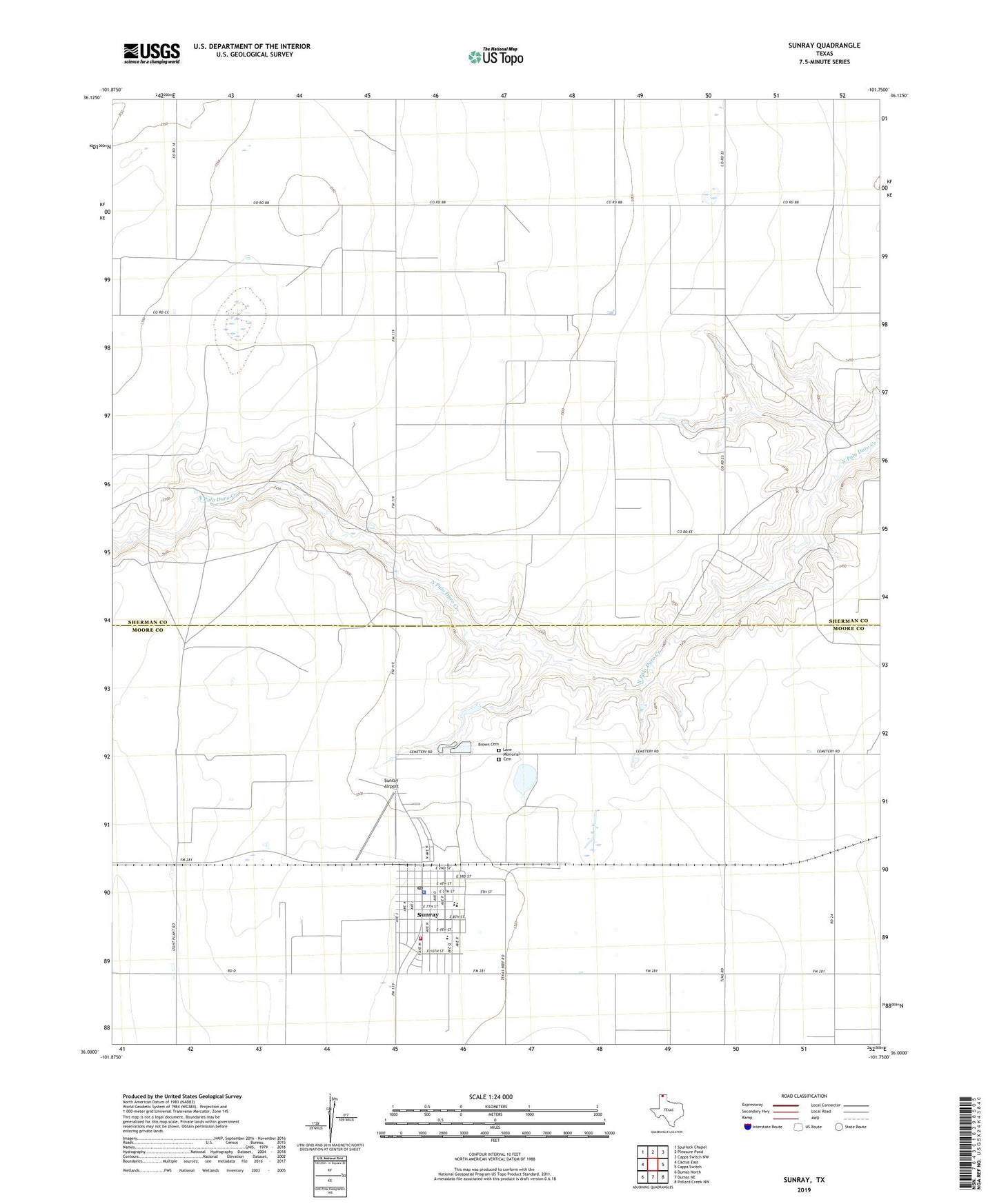
2022 topographic map quadrangle Sunray in the state of Texas. Scale: 1:24000. Based on the newly updated USGS 7.5' US Topo map series, this map is in the following counties: Sherman, Moore. The map contains contour data, water features, and other items you are used to seeing on USGS maps, but also has updated roads and other features. This is the next generation of topographic maps. Printed on high-quality waterproof paper with UV fade-resistant inks.
Quads adjacent to this one:
West: Cactus East
Northwest: Spurlock Chapel
North: Pleasure Pond
Northeast: Capps Switch NW
East: Capps Switch
Southeast: Pollard Creek NW
South: Dumas NE
Southwest: Dumas North
This map covers the same area as the classic USGS quad with code o36101a7.
Contains the following named places: Brown Cemetery, City of Sunray, Lane Memorial Cemetery, Roy Browder Airport, Sunray, Sunray Airport, Sunray City Hall, Sunray Fire Department and Emergency Medical Service, Sunray High School, Sunray Police Department, Sunray Post Office, ZIP Code: 79086