
MyTopo
Port Mansfield Texas US Topo Map
Couldn't load pickup availability
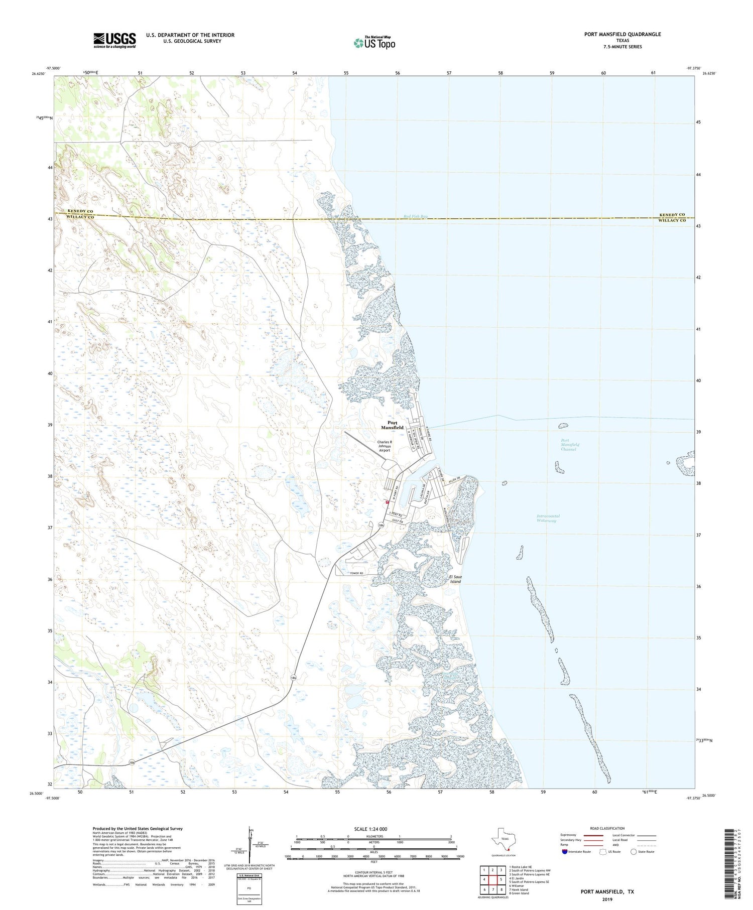
2019 topographic map quadrangle Port Mansfield in the state of Texas. Scale: 1:24000. Based on the newly updated USGS 7.5' US Topo map series, this map is in the following counties: Willacy, Kenedy. The map contains contour data, water features, and other items you are used to seeing on USGS maps, but also has updated roads and other features. This is the next generation of topographic maps. Printed on high-quality waterproof paper with UV fade-resistant inks.
Quads adjacent to this one:
West: El Jardin
Northwest: Rosita Lake NE
North: South of Potrero Lopeno NW
Northeast: South of Potrero Lopeno NE
East: South of Potrero Lopeno SE
Southeast: Green Island
South: Hawk Island
Southwest: Willamar
Contains the following named places: Agua Gorda Well South Windmill, Cabasenios Well, Casa de Pescadore Marina, Charles R Johnson Airport, Dave Dear Well, El Sauz Island, Fourmile Slough, Julian Well, Lava Manos Well, Palmital Well North Windmill, Palmital Well South Windmill, Port Mansfield, Port Mansfield Boat Basin Marina, Port Mansfield Census Designated Place, Port Mansfield Volunteer Fire Department, Red Fish Bay, Sausel Well, Willacy County Navigation District Marina, ZIP Code: 78598


