MyTopo
El Jardin Texas US Topo Map
Couldn't load pickup availability
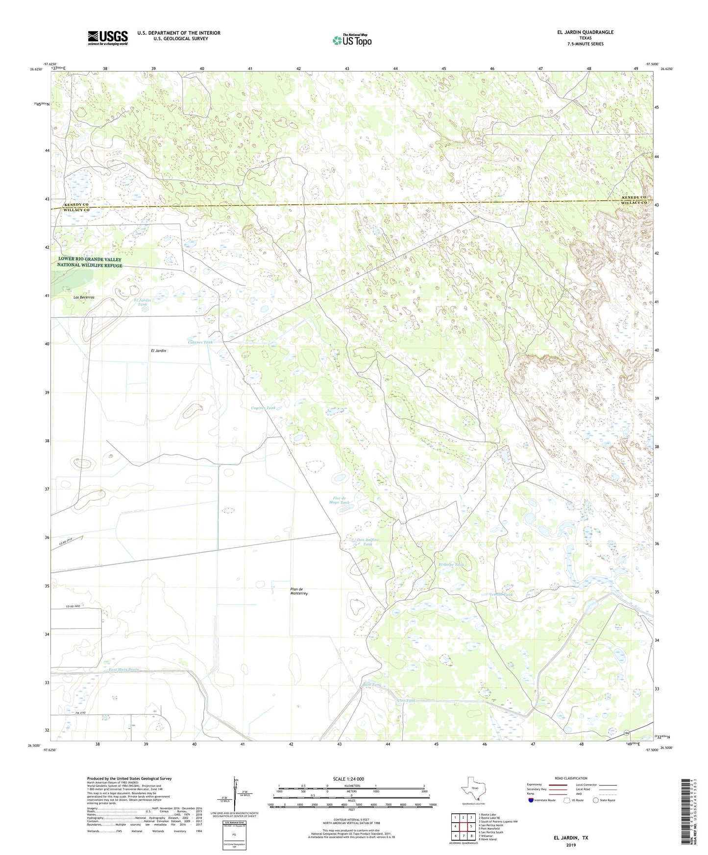
2022 topographic map quadrangle El Jardin in the state of Texas. Scale: 1:24000. Based on the newly updated USGS 7.5' US Topo map series, this map is in the following counties: Willacy, Kenedy. The map contains contour data, water features, and other items you are used to seeing on USGS maps, but also has updated roads and other features. This is the next generation of topographic maps. Printed on high-quality waterproof paper with UV fade-resistant inks.
Quads adjacent to this one:
West: San Perlita North
Northwest: Rosita Lake
North: Rosita Lake NE
Northeast: South of Potrero Lopeno NW
East: Port Mansfield
Southeast: Hawk Island
South: Willamar
Southwest: San Perlita South
This map covers the same area as the classic USGS quad with code o26097e5.
Contains the following named places: Beto Tank, Botellas Windmill, Buena Vista Windmill, Canteras Artesian Well, Catanes Tank, Cleo Tank, Coyotes Tank, Delfino Windmill, Desierto Windmill, Don Delfino Tank, Dos Mesquites Artesian Well, El Golpe Tank, El Jardin, El Jardin Tank, Estacas Lake, Flor de Mayo Tank, Jaboncillos Well, La Mar Artesian Well, La Sal Artesian Well, Laguna la Sal, Los Becerros, Marcelina Artesian Well, Monterrey Artesian Well, Monterrey Windmill, Perico Windmill, Plan de Monterrey, San Andreas Windmill, San Francisco Ranch, Telephone Artesian Well, Tenerias Windmill, Venado Tank