MyTopo
Hawk Island Texas US Topo Map
Couldn't load pickup availability
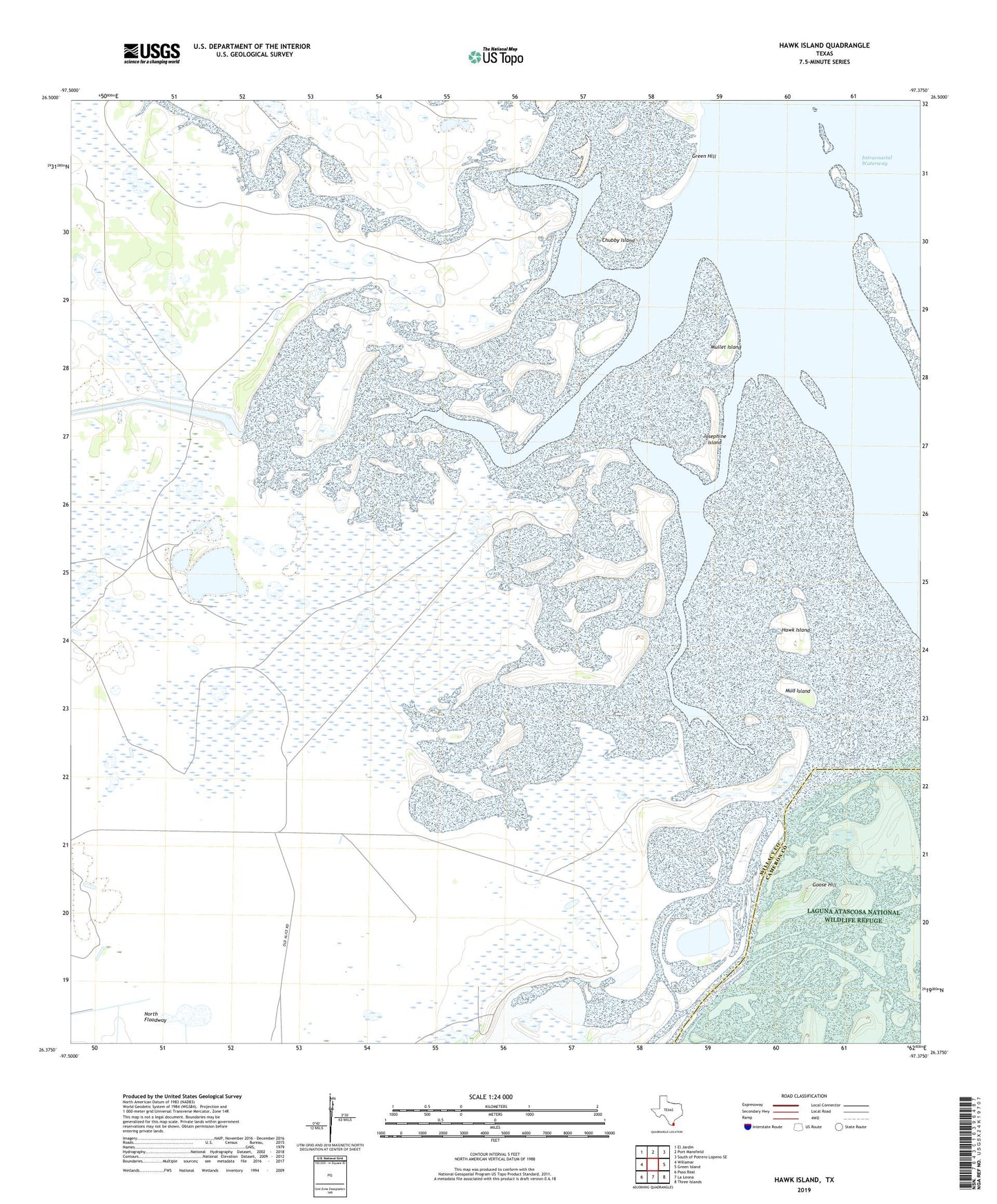
2022 topographic map quadrangle Hawk Island in the state of Texas. Scale: 1:24000. Based on the newly updated USGS 7.5' US Topo map series, this map is in the following counties: Willacy, Cameron. The map contains contour data, water features, and other items you are used to seeing on USGS maps, but also has updated roads and other features. This is the next generation of topographic maps. Printed on high-quality waterproof paper with UV fade-resistant inks.
Quads adjacent to this one:
West: Willamar
Northwest: El Jardin
North: Port Mansfield
Northeast: South of Potrero Lopeno SE
East: Green Island
Southeast: Three Islands
South: La Leona
Southwest: Paso Real
This map covers the same area as the classic USGS quad with code o26097d4.
Contains the following named places: Chubby Island, Goose Hill, Granjeno Well, Green Hill, Hawk Island, Josephine Island, La Oveja Well, La Torre Well, Las Cuatas Well, Loma Alta Well, Mud Island, Mullet Island, San Perlita Division, Tanke Chalie Well, Tanke Hal Well