MyTopo
Willamar Texas US Topo Map
Couldn't load pickup availability
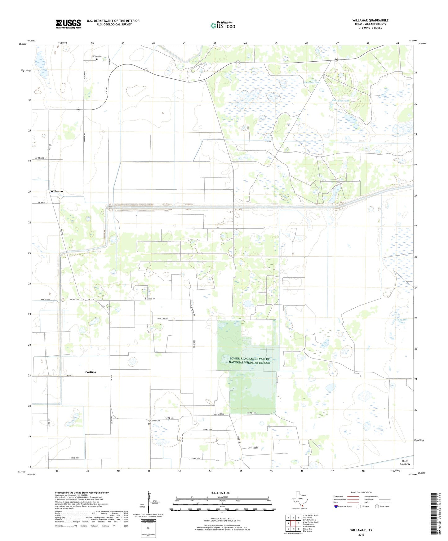
2022 topographic map quadrangle Willamar in the state of Texas. Scale: 1:24000. Based on the newly updated USGS 7.5' US Topo map series, this map is in the following counties: Willacy. The map contains contour data, water features, and other items you are used to seeing on USGS maps, but also has updated roads and other features. This is the next generation of topographic maps. Printed on high-quality waterproof paper with UV fade-resistant inks.
Quads adjacent to this one:
West: San Perlita South
Northwest: San Perlita North
North: El Jardin
Northeast: Port Mansfield
East: Hawk Island
Southeast: La Leona
South: Paso Real
Southwest: Willamar SW
This map covers the same area as the classic USGS quad with code o26097d5.
Contains the following named places: Cabellos Well, Cebalo Well, El Sabinto Ranch, El Sauz Ranch, El Toro Cemetery, Esterita Well, Gus Well, La Jarita Cemetery, La Jarita Ranch, Lampasosa Tank, Long Hill Tank, Madama Well, Mulatos Well, Nopal Well, Panalto Well, Porfirio, Porfirio Well, Precifa Well, Quemada Tank, Retamita Tank, Sacatosa Tank, San Francisco Well, Vacas Well, Willacy County, Willamar, Willamar Camp, Willamar Census Designated Place, Willamar Oil Field