MyTopo
Powell Texas US Topo Map
Couldn't load pickup availability
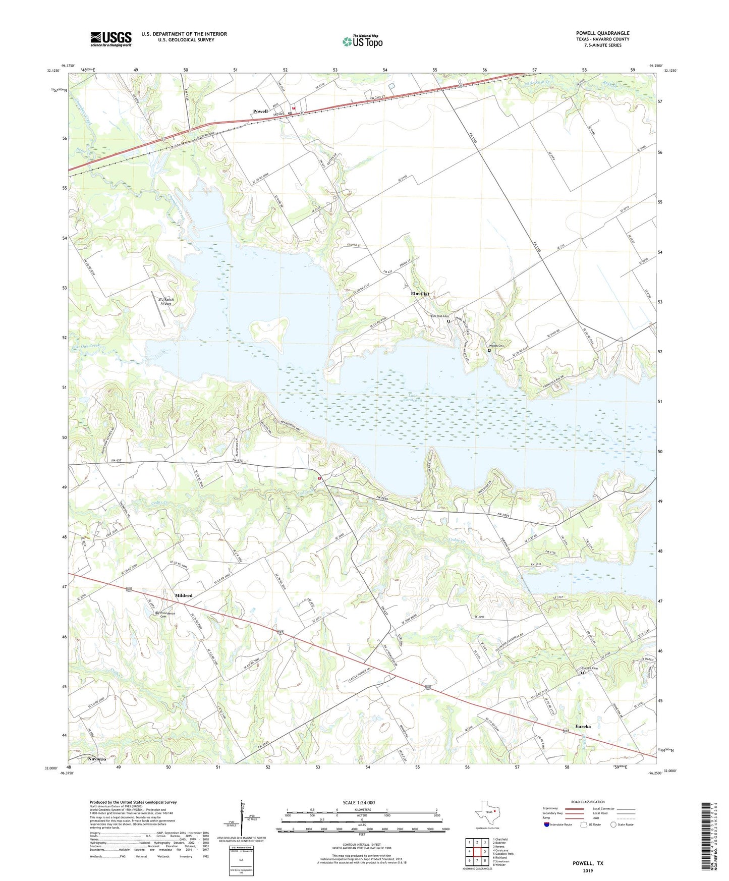
2019 topographic map quadrangle Powell in the state of Texas. Scale: 1:24000. Based on the newly updated USGS 7.5' US Topo map series, this map is in the following counties: Navarro. The map contains contour data, water features, and other items you are used to seeing on USGS maps, but also has updated roads and other features. This is the next generation of topographic maps. Printed on high-quality waterproof paper with UV fade-resistant inks.
Quads adjacent to this one:
West: Corsicana
Northwest: Chatfield
North: Bazette
Northeast: Kerens
East: Goodlow Park
Southeast: Winkler
South: Streetman
Southwest: Richland
Contains the following named places: Anderson Bridge, Briar Creek, Camp Wanica, Elm Flat, Elm Flat Cemetery, Eureka, Eureka Cemetery, Jameson Creek, JTJ Ranch Airport, Lake Corsicana, Lake Corsicana Dam, Little Rush Creek, Mildred Volunteer Fire Department, Post Oak Creek, Powell, Powell Post Office, Powell Volunteer Fire Department, Providence Cemetery, Providence Church, Soil Conservation Service Site 141 Dam, Soil Conservation Service Site 141 Reservoir, Town of Mildred, Town of Powell, Woods Cemetery, Woods Chapel, ZIP Code: 75109