MyTopo
Streetman Texas US Topo Map
Couldn't load pickup availability
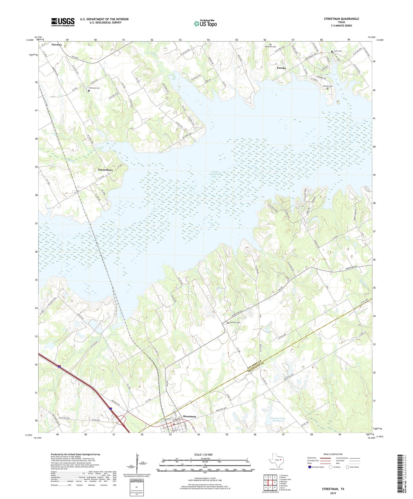
2022 topographic map quadrangle Streetman in the state of Texas. Scale: 1:24000. Based on the newly updated USGS 7.5' US Topo map series, this map is in the following counties: Navarro, Freestone. The map contains contour data, water features, and other items you are used to seeing on USGS maps, but also has updated roads and other features. This is the next generation of topographic maps. Printed on high-quality waterproof paper with UV fade-resistant inks.
Quads adjacent to this one:
West: Richland
Northwest: Corsicana
North: Powell
Northeast: Goodlow Park
East: Winkler
Southeast: Stewards Mill
South: Kirvin
Southwest: Wortham
This map covers the same area as the classic USGS quad with code o31096h3.
Contains the following named places: B T Averheart Airport, Birdston Cemetery, Birdston Valley Church, Byrt Airport, Cheneyboro, City of Eureka, Crab Creek, Dunn - Johnston Cemetery, Emerson Dam Number 1, Emerson Dam Number 2, Emerson Lake Number 1, Emerson Lake Number 2, Friendship Church, Grape Creek, Gunn Cemetery, Handcock Cemetery, Hopewell Cemetery, Jones Branch, Little Pin Oak Creek, Midway Church, Silent Grove Church, Streetman, Streetman Post Office, Texas Industries Levee, Town of Streetman