MyTopo
Winkler Texas US Topo Map
Couldn't load pickup availability
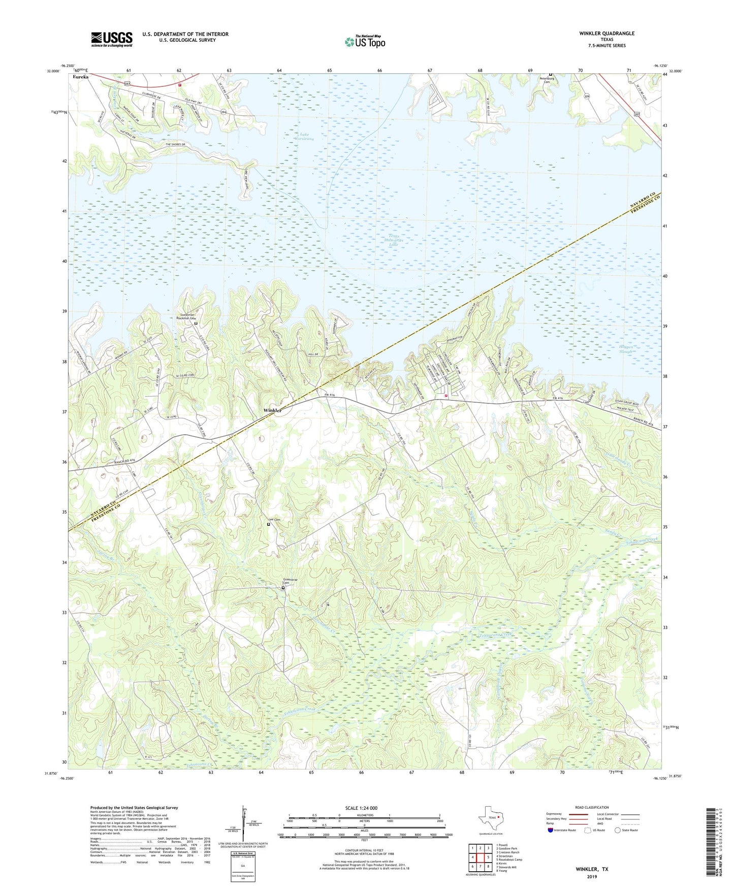
2022 topographic map quadrangle Winkler in the state of Texas. Scale: 1:24000. Based on the newly updated USGS 7.5' US Topo map series, this map is in the following counties: Freestone, Navarro. The map contains contour data, water features, and other items you are used to seeing on USGS maps, but also has updated roads and other features. This is the next generation of topographic maps. Printed on high-quality waterproof paper with UV fade-resistant inks.
Quads adjacent to this one:
West: Streetman
Northwest: Powell
North: Goodlow Park
Northeast: Creslenn Ranch
East: Roustabout Camp
Southeast: Young
South: Stewards Mill
Southwest: Kirvin
This map covers the same area as the classic USGS quad with code o31096h2.
Contains the following named places: Camphouse Dugout, Chambers Creek, Greenbriar Cemetery, Greenbriar Church, Greenbriar Creek, Hogpen Slough, Lee Cemetery, Long Arm Branch, New Hope Church, Petersburg Church, Pleasant Hill Church, Reka Oil Field, Richland Chambers 287 Fire and Rescue, Saint Elmo, Sandy Creek, Southern Oaks Volunteer Fire Department, Spring Branch, Stewards Mill Oil Field, Sweatman - Blackmon Cemetery, Texas Industries Lake, Winkler, ZIP Code: 75859