MyTopo
Richland Texas US Topo Map
Couldn't load pickup availability
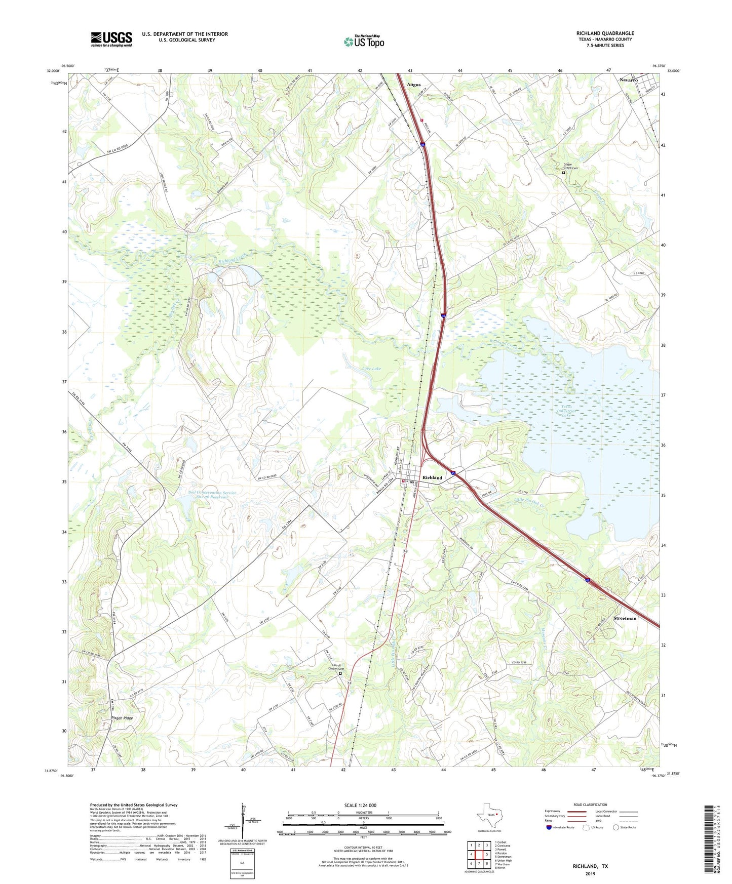
2022 topographic map quadrangle Richland in the state of Texas. Scale: 1:24000. Based on the newly updated USGS 7.5' US Topo map series, this map is in the following counties: Navarro. The map contains contour data, water features, and other items you are used to seeing on USGS maps, but also has updated roads and other features. This is the next generation of topographic maps. Printed on high-quality waterproof paper with UV fade-resistant inks.
Quads adjacent to this one:
West: Purdon
Northwest: Corbet
North: Corsicana
Northeast: Powell
East: Streetman
Southeast: Kirvin
South: Wortham
Southwest: Union High
This map covers the same area as the classic USGS quad with code o31096h4.
Contains the following named places: Carroll Chapel Cemetery, City of Angus, Grape Creek Cemetery, Love Lake, Mesquite Creek, Navarro, Patterson Lake, Pin Oak Creek, Pisgah Ridge, Richland, Richland Civic Center, Richland Division, Richland Post Office, Richland Volunteer Fire Department, Soil Conservation Service Site 36 Dam, Soil Conservation Service Site 36 Reservoir, Town of Richland, ZIP Code: 76681