MyTopo
Premont West Texas US Topo Map
Couldn't load pickup availability
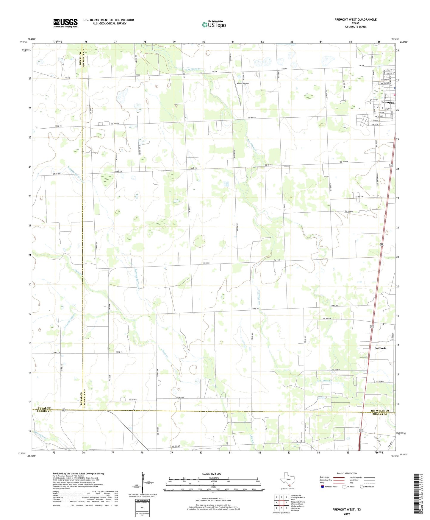
2019 topographic map quadrangle Premont West in the state of Texas. Scale: 1:24000. Based on the newly updated USGS 7.5' US Topo map series, this map is in the following counties: Jim Wells, Duval, Brooks. The map contains contour data, water features, and other items you are used to seeing on USGS maps, but also has updated roads and other features. This is the next generation of topographic maps. Printed on high-quality waterproof paper with UV fade-resistant inks.
Quads adjacent to this one:
West: Laguna Del Toro
Northwest: Concepcion
North: Seeligson Ranch
Northeast: Ella
East: Premont East
Southeast: Flowella
South: Falfurrias
Southwest: Palomas Ranch
Contains the following named places: Alto Verde Windmill, Jim Wells County Sheriff's Office, KMFM-FM (Premont), La Gloria, La Gloria Elementary School, La Gloria Oil Field, Lagunas Negras, Lewis Heliport, Premont Central Elementary School, Premont City Hall, Premont Division, Premont High School, Premont Junior High School, Premont Police Department, Premont Volunteer Fire Department, Ramada del Toro Creek, Trevino Windmill, Weeks Airport