MyTopo
Flowella Texas US Topo Map
Couldn't load pickup availability
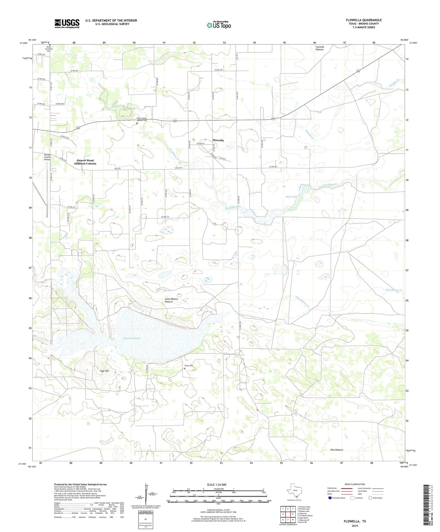
2022 topographic map quadrangle Flowella in the state of Texas. Scale: 1:24000. Based on the newly updated USGS 7.5' US Topo map series, this map is in the following counties: Brooks. The map contains contour data, water features, and other items you are used to seeing on USGS maps, but also has updated roads and other features. This is the next generation of topographic maps. Printed on high-quality waterproof paper with UV fade-resistant inks.
Quads adjacent to this one:
West: Falfurrias
Northwest: Premont West
North: Premont East
Northeast: Paisano Lake
East: La Paloma Ranch
Southeast: Sarita SW
South: Falfurrias SE
Southwest: Cage Ranch
This map covers the same area as the classic USGS quad with code o27098b1.
Contains the following named places: Airport Road Addition, Airport Road Addition Census Designated Place, Airport Road Addition Colonia, Arroyo Baluarte, Betty Lou Windmill, Brooks County Airport, Chamberlain Oil Field, Cuchilla Pasture, Flowella, Flowella Census Designated Place, Flowella Oil Field, Gardner Ranch, Gyp Hill, Gyp Hill Oil Field, Indian Ranch, Laguna Salada, Loma Blanca Pasture, Mariposa Oil Field, Mariposa Ranch, New Pens Well, Old Pens Well, Pedro Garza Zamaora Cemetery, Pedro Jaramillo Cemetery, Perez Cemetery Number 01, Perez Ranch, Pita Pasture, Rush Addition Colonia, Salt Well, Texas Well, West Dam, West Lake