
MyTopo
Ranger Texas US Topo Map
Couldn't load pickup availability
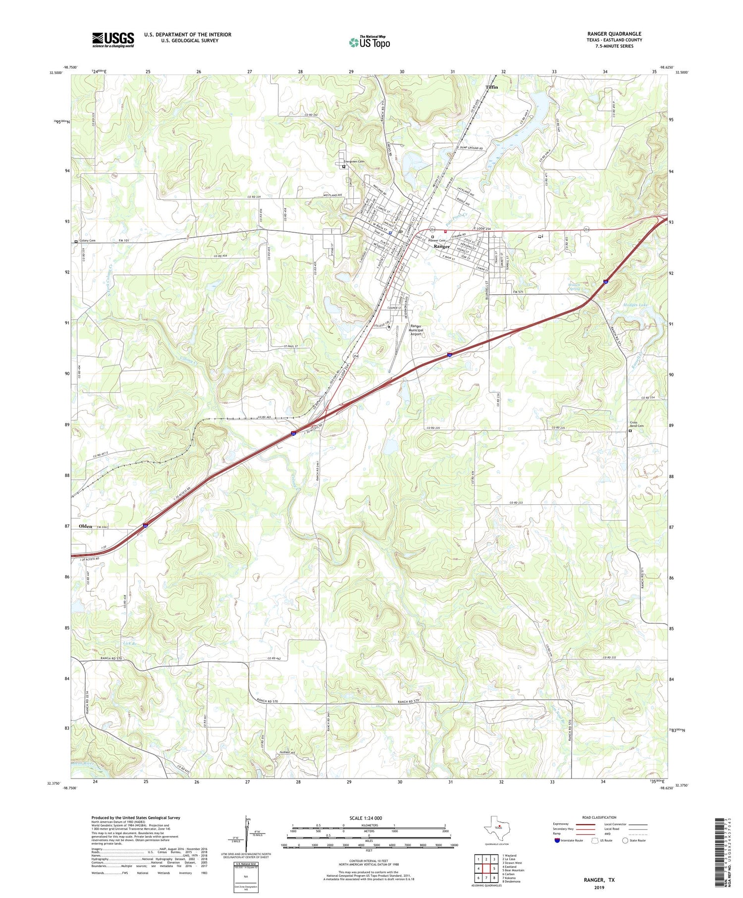
2019 topographic map quadrangle Ranger in the state of Texas. Scale: 1:24000. Based on the newly updated USGS 7.5' US Topo map series, this map is in the following counties: Eastland. The map contains contour data, water features, and other items you are used to seeing on USGS maps, but also has updated roads and other features. This is the next generation of topographic maps. Printed on high-quality waterproof paper with UV fade-resistant inks.
Quads adjacent to this one:
West: Eastland
Northwest: Wayland
North: La Casa
Northeast: Strawn West
East: Bear Mountain
Southeast: Desdemona
South: Kokomo
Southwest: Carbon
Contains the following named places: Catholic Church Saint Rita, Church of Christ, Church of God, City of Ranger, Colony Cemetery, Cross Bend Cemetery, Eastland County Constable's Office Precinct 2, Evergreen Cemetery, Hagaman Lake, Hagaman Lake Dam, Hodges Dam, Hodges Lake, Merriman, Merriman Church, North Fork Colony Creek, Pioneer Cemetery, Ranger, Ranger Fire Department and Emergency Medical Service, Ranger Municipal Airport, Ranger Police Department, Ranger Post Office, Tiffin, Winsett Spring, Young School, ZIP Codes: 76466, 76470


