MyTopo
Reagan Texas US Topo Map
Couldn't load pickup availability
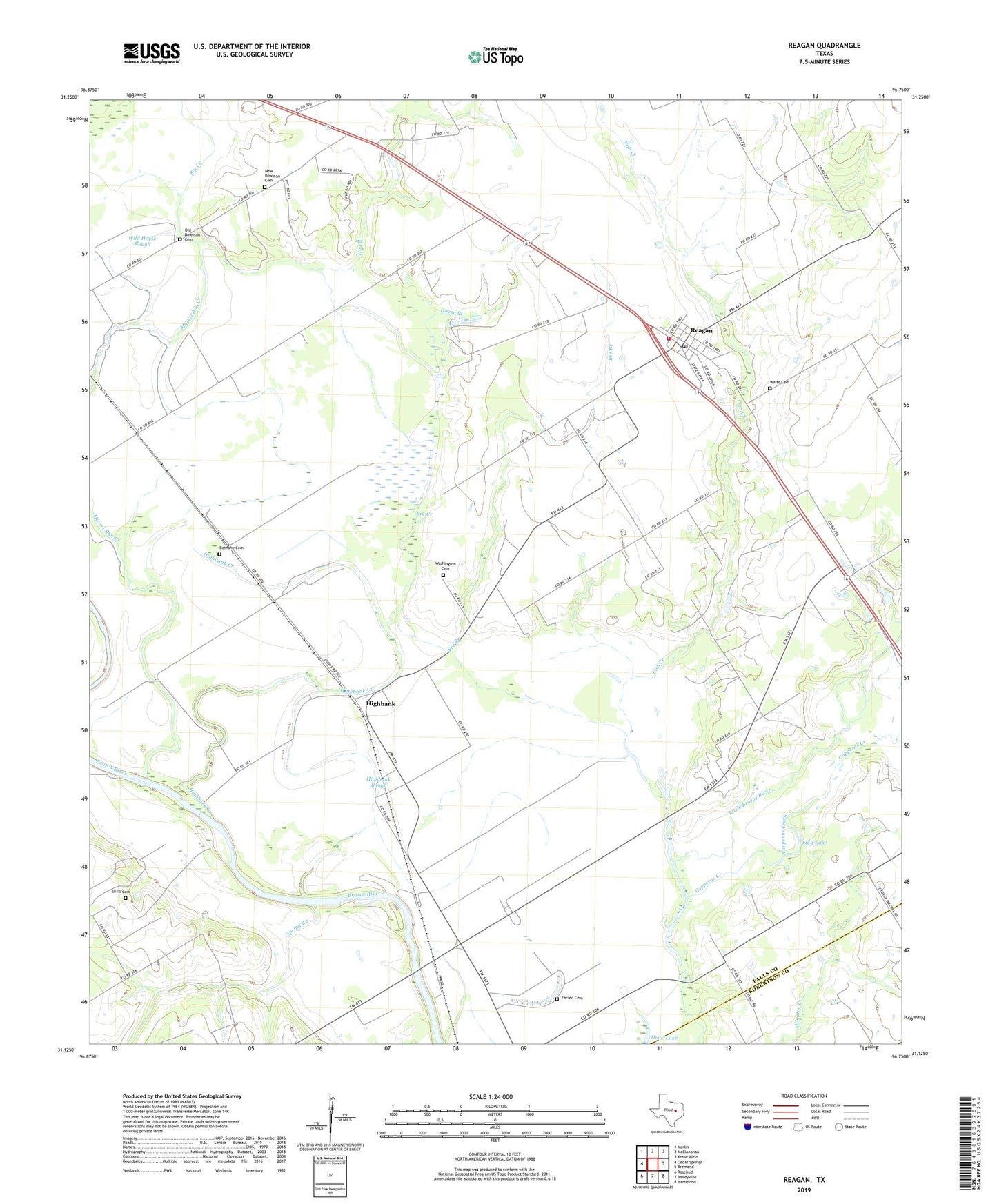
2019 topographic map quadrangle Reagan in the state of Texas. Scale: 1:24000. Based on the newly updated USGS 7.5' US Topo map series, this map is in the following counties: Falls, Robertson. The map contains contour data, water features, and other items you are used to seeing on USGS maps, but also has updated roads and other features. This is the next generation of topographic maps. Printed on high-quality waterproof paper with UV fade-resistant inks.
Quads adjacent to this one:
West: Cedar Springs
Northwest: Marlin
North: McClanahan
Northeast: Kosse West
East: Bremond
Southeast: Hammond
South: Baileyville
Southwest: Rosebud
Contains the following named places: Beacon, Bee Branch, Bethany Cemetery, Big Creek, Bowman Chapel, Copperas Creek, Coymack, Facieo Cemetery, Fish Creek, Fish Creek Church, Flag Lake, Goose Branch, Highbank, Highbank Creek, Highbank Slough, Hog Branch, New Bowman Cemetery, Old Bowman Cemetery, Reagan, Reagan Division, Reagan Post Office, Reagan Volunteer Fire Department, Saint Paul Church, Shilo Cemetery, Spring Branch, Waite Cemetery, Washington Cemetery, ZIP Code: 76680