MyTopo
Reddy Mountain Texas US Topo Map
Couldn't load pickup availability
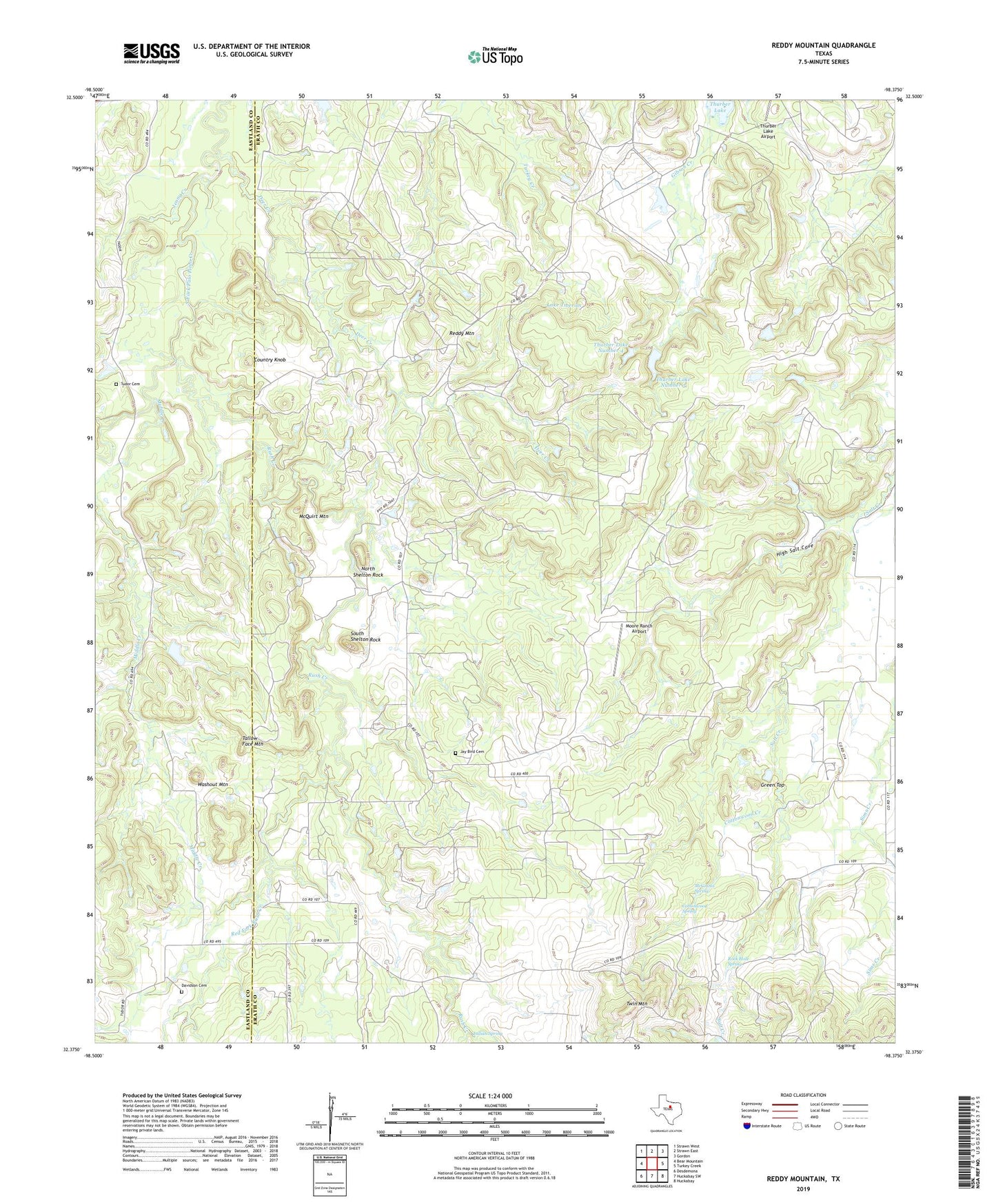
2019 topographic map quadrangle Reddy Mountain in the state of Texas. Scale: 1:24000. Based on the newly updated USGS 7.5' US Topo map series, this map is in the following counties: Erath, Eastland. The map contains contour data, water features, and other items you are used to seeing on USGS maps, but also has updated roads and other features. This is the next generation of topographic maps. Printed on high-quality waterproof paper with UV fade-resistant inks.
Quads adjacent to this one:
West: Bear Mountain
Northwest: Strawn West
North: Strawn East
Northeast: Gordon
East: Turkey Creek
Southeast: Huckabay
South: Huckabay SW
Southwest: Desdemona
Contains the following named places: Cottonwood Creek, Cottonwood Spring, Country Knob, Davidson Cemetery, Deer Creek, Green Top, High Salt Cove, Indian Spring, Jay Bird Cemetery, Jenny Creek, Lake Tiberias, McGinnis Spring, McQuirt Mountain, Middle Creek, Moore Ranch Airport, North Shelton Rock, Red Fork Rush Creek, Reddy Mountain, Rock Hole Spring, Rush Creek, South Shelton Rock, Tallow Face Mountain, Thurber Lake Number 4, Thurber Lake Number 4 Dam, Thurber Lake Number 5, Thurber Lake Number 5 Dam, Tudor Cemetery, Twin Mountain, Washout Mountain, ZIP Code: 76463