MyTopo
Rhome Texas US Topo Map
Couldn't load pickup availability
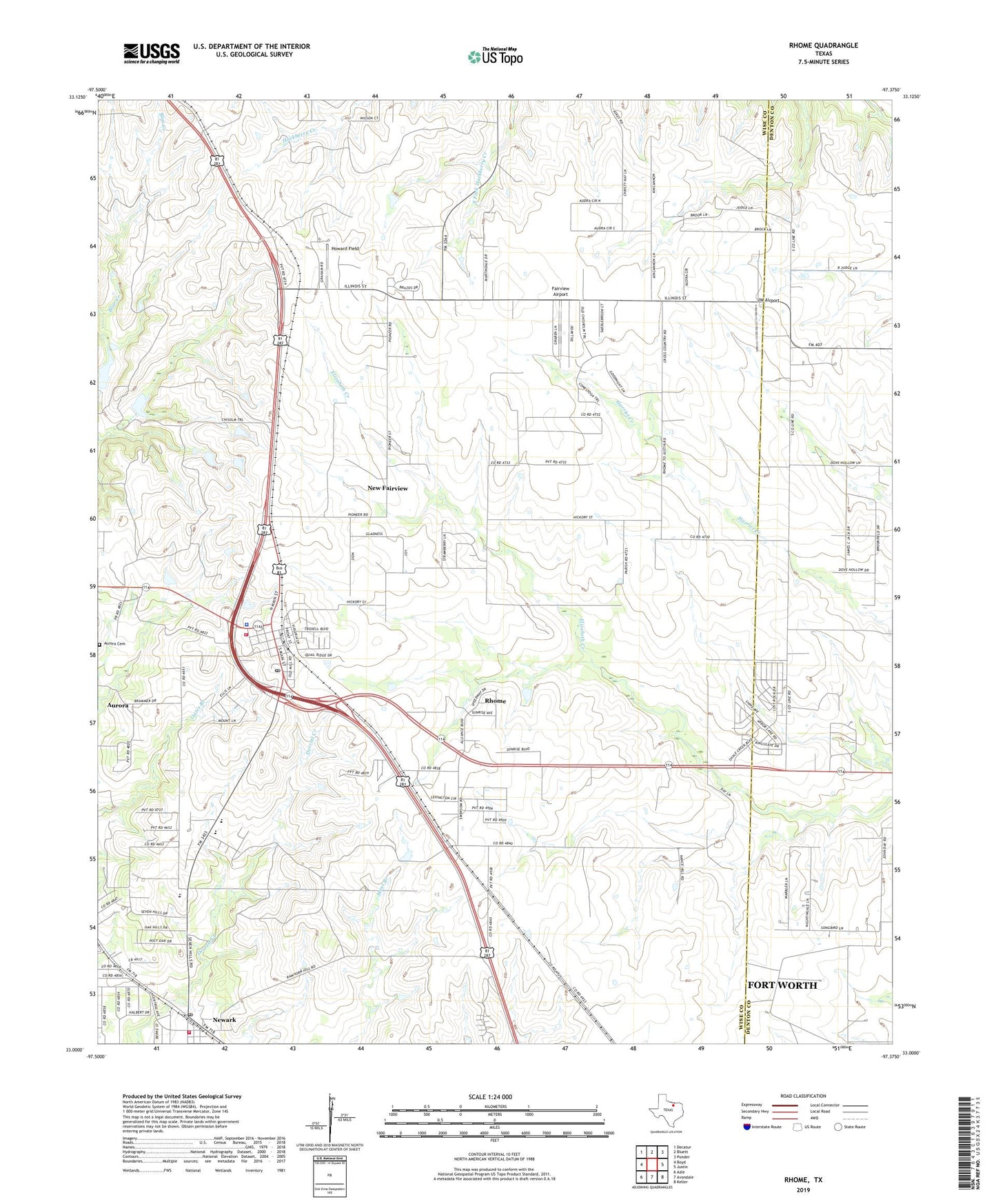
2019 topographic map quadrangle Rhome in the state of Texas. Scale: 1:24000. Based on the newly updated USGS 7.5' US Topo map series, this map is in the following counties: Wise, Denton. The map contains contour data, water features, and other items you are used to seeing on USGS maps, but also has updated roads and other features. This is the next generation of topographic maps. Printed on high-quality waterproof paper with UV fade-resistant inks.
Quads adjacent to this one:
West: Boyd
Northwest: Decatur
North: Bluett
Northeast: Ponder
East: Justin
Southeast: Keller
South: Avondale
Southwest: Azle
Contains the following named places: Aurora Cemetery, Bryan, Chisholm Trail Middle School, City Hall of Rhome, City of New Fairview, City of Rhome, Fairview Airport, Fairview Church, Howard Field, JW Airport, New Fairview, New Fairview City Hall, Newark, Newark City Hall, Newark Post Office, Newark Volunteer Fire Department, Rhome, Rhome Fire Department, Rhome Police Department, Rhome Post Office, Willow Run Airport, ZIP Codes: 76071, 76078