MyTopo
Rio Grande Village Texas US Topo Map
Couldn't load pickup availability
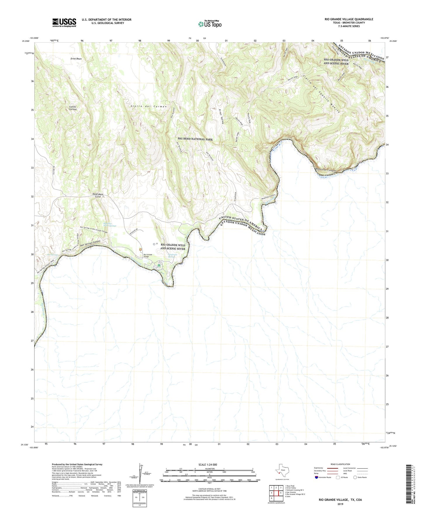
2022 topographic map quadrangle Rio Grande Village in the state of Texas. Scale: 1:24000. Based on the newly updated USGS 7.5' US Topo map series, this map is in the following counties: Brewster. The map contains contour data, water features, and other items you are used to seeing on USGS maps, but also has updated roads and other features. This is the next generation of topographic maps. Printed on high-quality waterproof paper with UV fade-resistant inks.
Quads adjacent to this one:
West: San Vicente
Northwest: Roys Peak
North: Ernst Valley
Northeast: Stillwell Crossing OE S
East: Rio Grande Village OE E
Southwest: Solis
This map covers the same area as the classic USGS quad with code o29102b8.
Contains the following named places: Boquillas Canyon, Boquillas Canyon Overlook, Boquillas Canyon Trail, Boquillas Crossing, Boquillas Warm Springs, Daniels Farm House, Dead Mans Curve, Ernst Valley, Gambusia Spring, Hot Springs, Hot Springs Canyon, Marufa Vega Trail, Ore Terminal Aerial Tramway, Ore Terminal Trail, Rio Grande Overlook, Rio Grande Village, Rio Grande Village Nature Trail, Tornillo Creek