MyTopo
Ernst Valley Texas US Topo Map
Couldn't load pickup availability
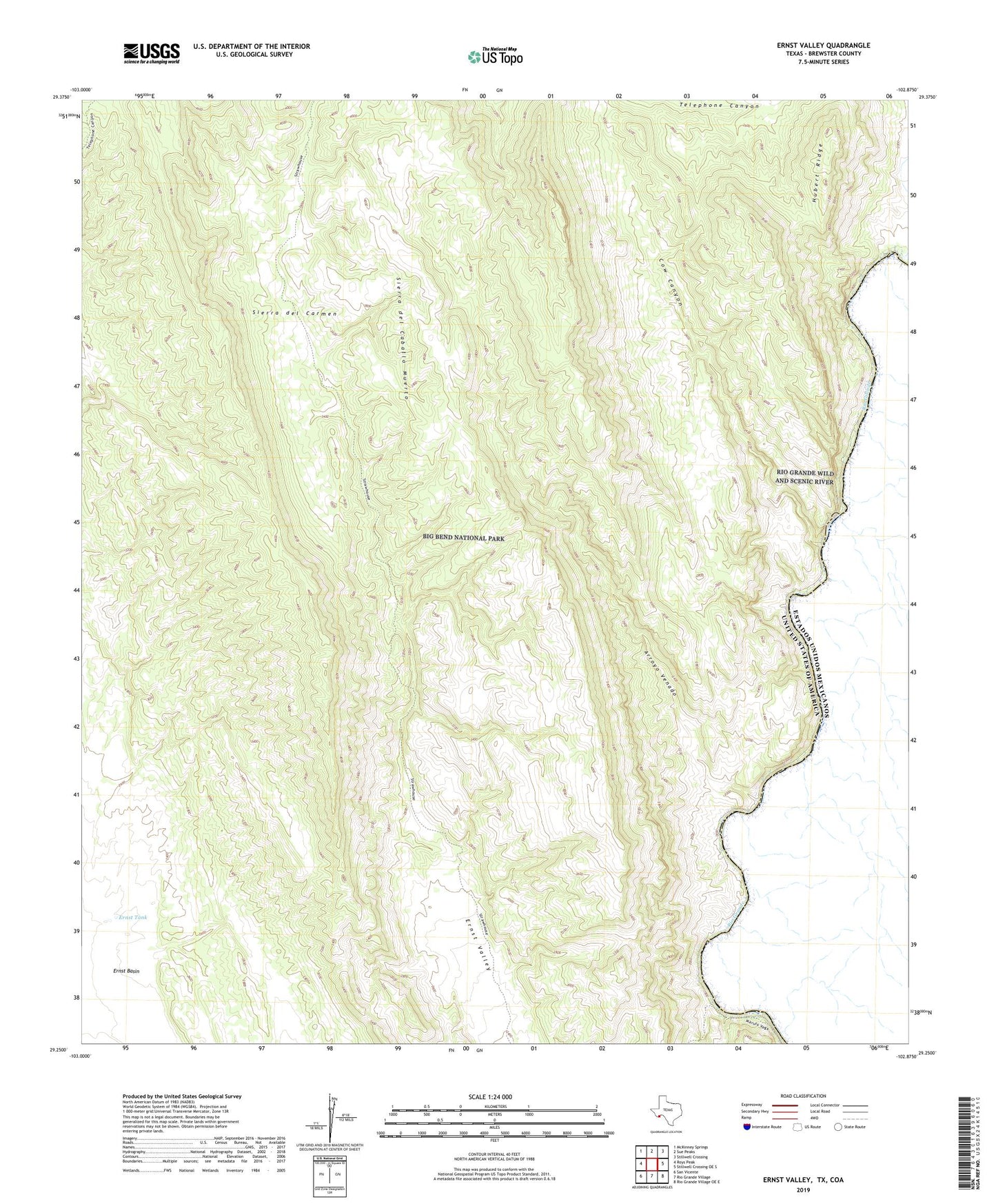
2022 topographic map quadrangle Ernst Valley in the state of Texas. Scale: 1:24000. Based on the newly updated USGS 7.5' US Topo map series, this map is in the following counties: Brewster. The map contains contour data, water features, and other items you are used to seeing on USGS maps, but also has updated roads and other features. This is the next generation of topographic maps. Printed on high-quality waterproof paper with UV fade-resistant inks.
Quads adjacent to this one:
West: Roys Peak
Northwest: McKinney Springs
North: Sue Peaks
Northeast: Stillwell Crossing
East: Stillwell Crossing OE S
Southeast: Rio Grande Village OE E
South: Rio Grande Village
Southwest: San Vicente
This map covers the same area as the classic USGS quad with code o29102c8.
Contains the following named places: Arroyo Venado, Cow Canyon, Ernst Basin, Ernst Tank, Heath Creek, Hubert Ridge, Sierra del Caballo Muerto, Strawhouse Trail