MyTopo
Alleyton Texas US Topo Map
Couldn't load pickup availability
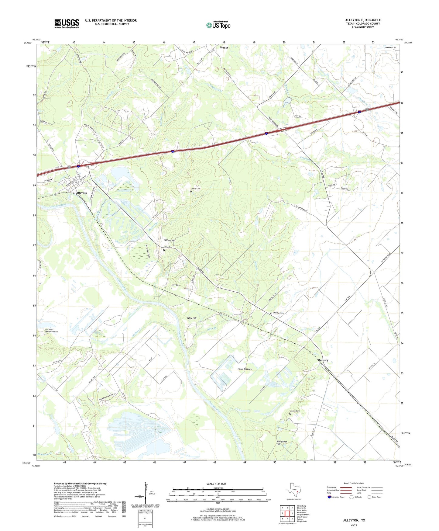
2022 topographic map quadrangle Alleyton in the state of Texas. Scale: 1:24000. Based on the newly updated USGS 7.5' US Topo map series, this map is in the following counties: Colorado. The map contains contour data, water features, and other items you are used to seeing on USGS maps, but also has updated roads and other features. This is the next generation of topographic maps. Printed on high-quality waterproof paper with UV fade-resistant inks.
Quads adjacent to this one:
West: Columbus
Northwest: Frelsburg
North: Bernardo
Northeast: Cat Spring
East: Eagle Lake NE
Southeast: Eagle Lake
South: Altair
Southwest: Rock Island
This map covers the same area as the classic USGS quad with code o29096f4.
Contains the following named places: Adams Cemetery, Allen Branch, Allen Cemetery, Alley Cemetery, Alley Hill, Alley House, Alleyton, Atascosito Crossing, Grewe Cemetery, Hahn Bottoms, Horseshoe Gully, Jay Ray, Laban, Live Oak Creek, Mexican Cemetery, Middle Brook Hill, Mineral Branch, Pinchback Obenchain Cemetery, Ramsey, Ramsey Gas Field, Sandy Branch, Wilson Hill, Wolfpen Creek, ZIP Code: 78935