MyTopo
Rockland Texas US Topo Map
Couldn't load pickup availability
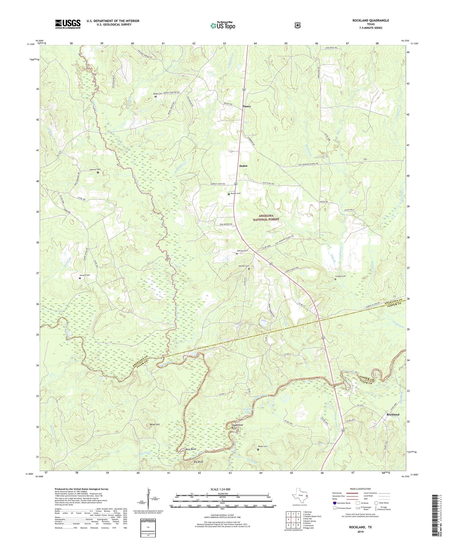
2019 topographic map quadrangle Rockland in the state of Texas. Scale: 1:24000. Based on the newly updated USGS 7.5' US Topo map series, this map is in the following counties: Angelina, Tyler, Jasper. The map contains contour data, water features, and other items you are used to seeing on USGS maps, but also has updated roads and other features. This is the next generation of topographic maps. Printed on high-quality waterproof paper with UV fade-resistant inks.
Quads adjacent to this one:
West: Wolf Hill
Northwest: Manning
North: Zavalla
Northeast: Cassells-Boykin Park
East: Boykin Spring
Southeast: Boggy Lake
South: Colmesneil
Southwest: Chester
Contains the following named places: Alligator Lake, Barge Cemetery, Best Bend, Big Bluff, Billiams Creek, Cameron Cemetery, Crane Branch, Cypress Creek, Dolan, Dunkin Cemetery, Graham Cemetery, Greenwood Creek, Grimes Creek, Gum Branch, Havard Cemetery, Historic Monument of Fort Teran, Johnson Cemetery, Kitchen Cemetery, Martin, McGraw Creek, Miles Hill, Mill Creek, Nancy, Oil Well Creek, Rockland, Rocky Hole Branch, Russell Creek, Saline Creek, Sandy Creek, Shawnee Creek, Sheephead Bend, Sulphur Branch, Sulphur Springs Church, Turpentine Creek, Weeks Branch, Weeks Cemetery