MyTopo
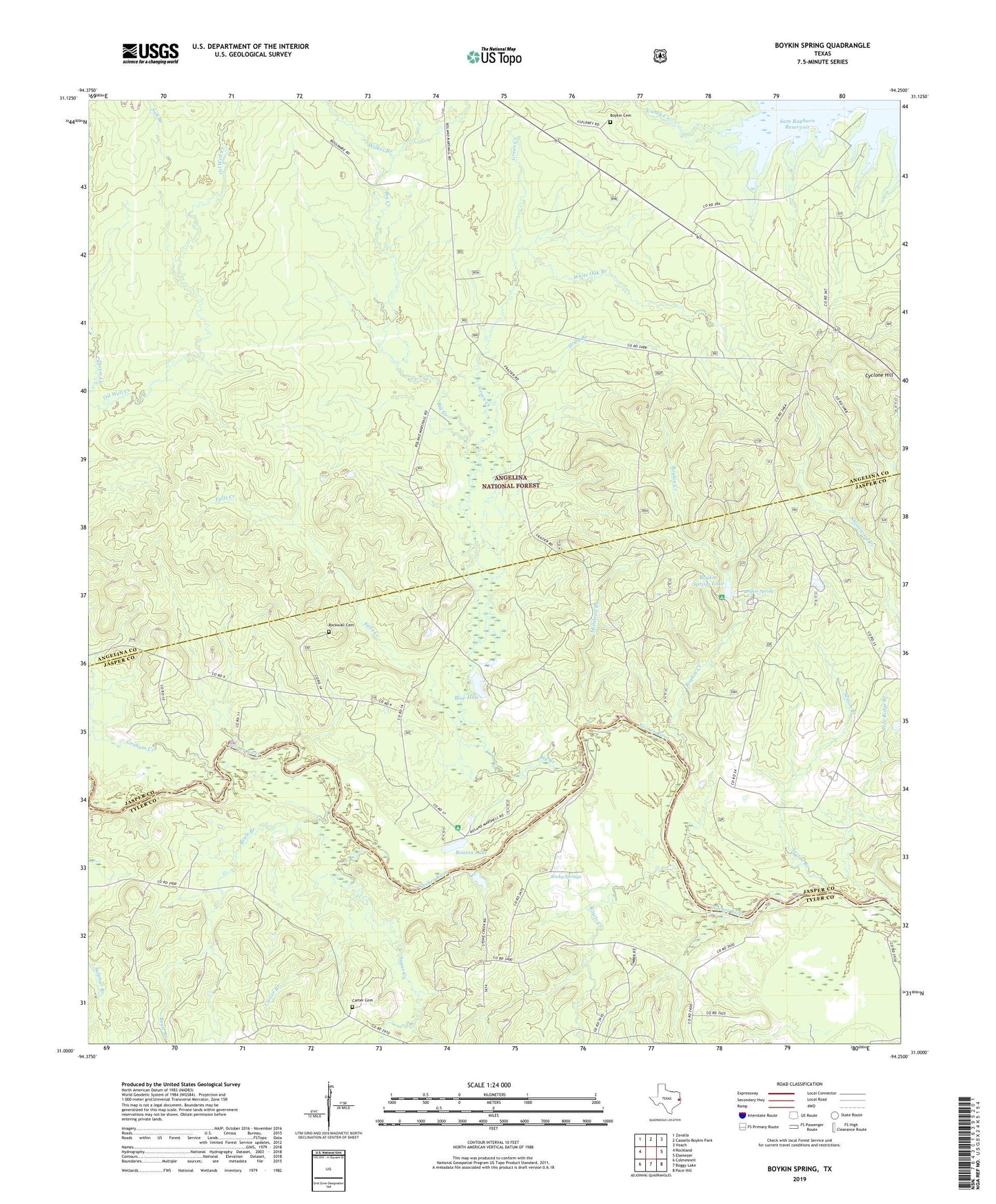
Boykin Spring Texas US Topo Map
Couldn't load pickup availability
Also explore the Boykin Spring Forest Service Topo of this same quad for updated USFS data
2022 topographic map quadrangle Boykin Spring in the state of Texas. Scale: 1:24000. Based on the newly updated USGS 7.5' US Topo map series, this map is in the following counties: Angelina, Jasper, Tyler. The map contains contour data, water features, and other items you are used to seeing on USGS maps, but also has updated roads and other features. This is the next generation of topographic maps. Printed on high-quality waterproof paper with UV fade-resistant inks.
Quads adjacent to this one:
West: Rockland
Northwest: Zavalla
North: Cassells-Boykin Park
Northeast: Veach
East: Ebenezer
Southeast: Pace Hill
South: Boggy Lake
Southwest: Colmesneil
This map covers the same area as the classic USGS quad with code o31094a3.
Contains the following named places: Beale Branch, Big Creek, Blue Hole, Bouton Lake, Bouton Lake Recreation Site, Boykin Cemetery, Boykin Creek, Boykin Lake Dam, Boykin Spring, Boykin Spring Lake, Boykin Springs Recreation Area, Caney Creek, Carter Branch, Carter Cemetery, Concord, Cyclone Hill, Falls Creek, Graham Creek, Green Creek, Holly Branch, Millstead Branch, Old Aldredge Mill Site, Pole Ridge Branch, Rawls Creek, Rockwall Cemetery, Rockwall Church, Rocky Springs, Rocky Springs Church, Salt Branch, Sawmill Hiking Trail, Sexton Branch, Sugar Creek, Upland Island Wilderness, Vernon School, White Oak Branch, Wilkes Branch