MyTopo
Ross Mountain Texas US Topo Map
Couldn't load pickup availability
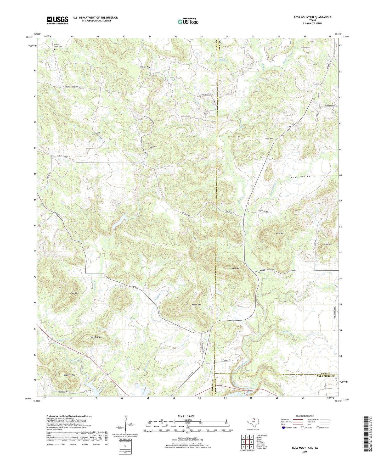
2019 topographic map quadrangle Ross Mountain in the state of Texas. Scale: 1:24000. Based on the newly updated USGS 7.5' US Topo map series, this map is in the following counties: Young, Jack, Palo Pinto. The map contains contour data, water features, and other items you are used to seeing on USGS maps, but also has updated roads and other features. This is the next generation of topographic maps. Printed on high-quality waterproof paper with UV fade-resistant inks.
Quads adjacent to this one:
West: Graham
Northwest: Lake Eddleman
North: Bryson
Northeast: Senate
East: Long Hollow
Southeast: Graford West
South: Costello Island
Southwest: Cove Creek
Contains the following named places: Bear Mountain, Board Timber Creek, Board Tree Creek, Boaro Timber Creek, Cement Mountain, Center Ridge Cemetery, Coon Branch, Dillingham Creek, Flag Mountain, Indian Mountain, Kisinger Mountain, McCumber Branch, Pinnington Creek, Pitts Mountain, Ross Mountain, Ross Valley, Shin Oak Mountain, Tripp Hill