MyTopo
Costello Island Texas US Topo Map
Couldn't load pickup availability
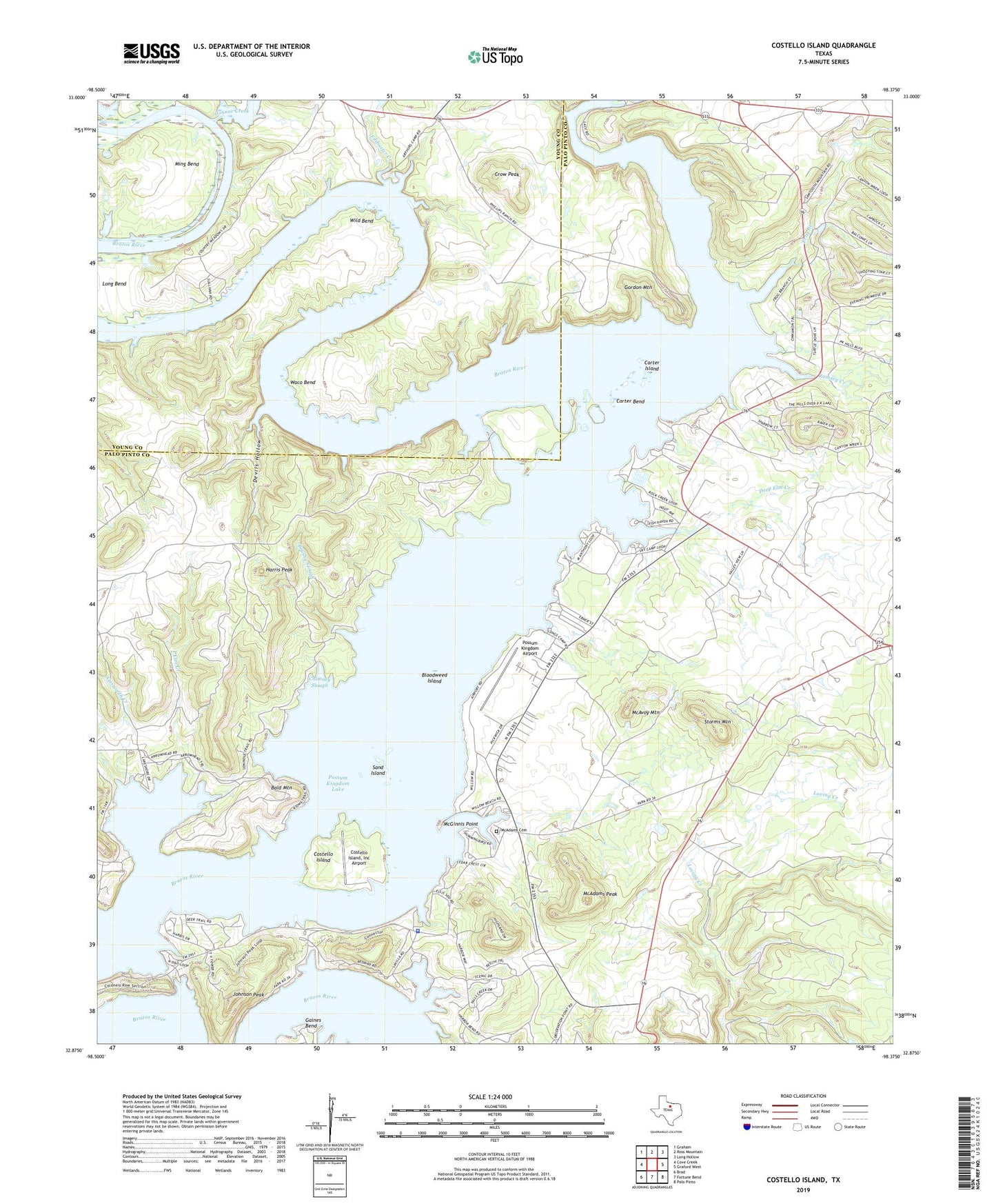
2022 topographic map quadrangle Costello Island in the state of Texas. Scale: 1:24000. Based on the newly updated USGS 7.5' US Topo map series, this map is in the following counties: Palo Pinto, Young. The map contains contour data, water features, and other items you are used to seeing on USGS maps, but also has updated roads and other features. This is the next generation of topographic maps. Printed on high-quality waterproof paper with UV fade-resistant inks.
Quads adjacent to this one:
West: Cove Creek
Northwest: Graham
North: Ross Mountain
Northeast: Long Hollow
East: Graford West
Southeast: Palo Pinto
South: Fortune Bend
Southwest: Brad
This map covers the same area as the classic USGS quad with code o32098h4.
Contains the following named places: Ainsworth Creek, Bald Mountain, Bloodweed Island, Brushy Slough, Carter Bend, Carter Island, Chimney Slough, Connor Creek, Costello Island, Costello Island Inc Airport, Crow Peak, Deep Elm Creek, Devils Hollow, Elm Creek, Filibuster Creek, Frog Branch, Gordon Mountain, Harris Peak, Johnson Peak, Lukingdom Church, McAdams Cemetery, McAdams Peak, McAvoy Mountain, McGinnis Point, Ming Bend, Palo Pinto County Sheriff's Office Possum Kingdom Lake Substation, Possum Kingdom Airport, Possum Kingdom Lake Volunteer Emergency Medical Services, Ramsey Creek, Rock Creek, Sand Island, Storms Mountain, Waco Bend, Wild Bend