MyTopo
Rotan Texas US Topo Map
Couldn't load pickup availability
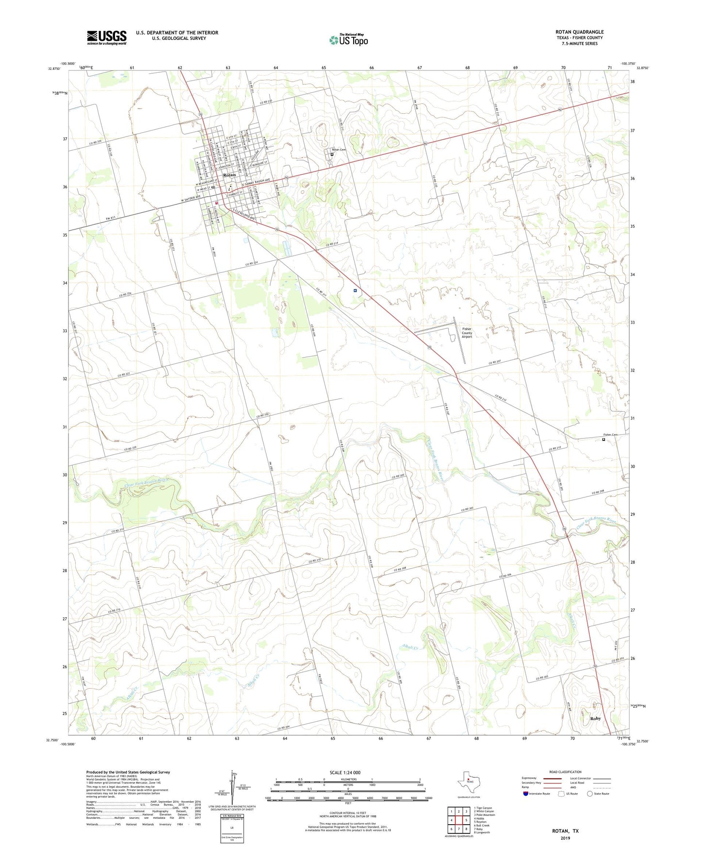
2022 topographic map quadrangle Rotan in the state of Texas. Scale: 1:24000. Based on the newly updated USGS 7.5' US Topo map series, this map is in the following counties: Fisher. The map contains contour data, water features, and other items you are used to seeing on USGS maps, but also has updated roads and other features. This is the next generation of topographic maps. Printed on high-quality waterproof paper with UV fade-resistant inks.
Quads adjacent to this one:
West: Hobbs
Northwest: Tige Canyon
North: White Canyon
Northeast: Poke Mountain
East: Royston
Southeast: Longworth
South: Roby
Southwest: Bull Creek
This map covers the same area as the classic USGS quad with code o32100g4.
Contains the following named places: Aaron Park, Alkali Creek, Belvieu Cemetery, Church of Christ, City of Rotan, First Baptist Church of Rotan, Fisher, Fisher Cemetery, Fisher County Airport, Fisher County Hospital, Hackberry Creek, Hemphill County Library, North Roby, North Roby Church, Rotan, Rotan City Hall, Rotan Elementary School, Rotan High School, Rotan Junior High School, Rotan Post Office, Rotan Volunteer Fire Department, Saint Joseph Baptist Church, Sardis