MyTopo
Saddle Butte Texas US Topo Map
Couldn't load pickup availability
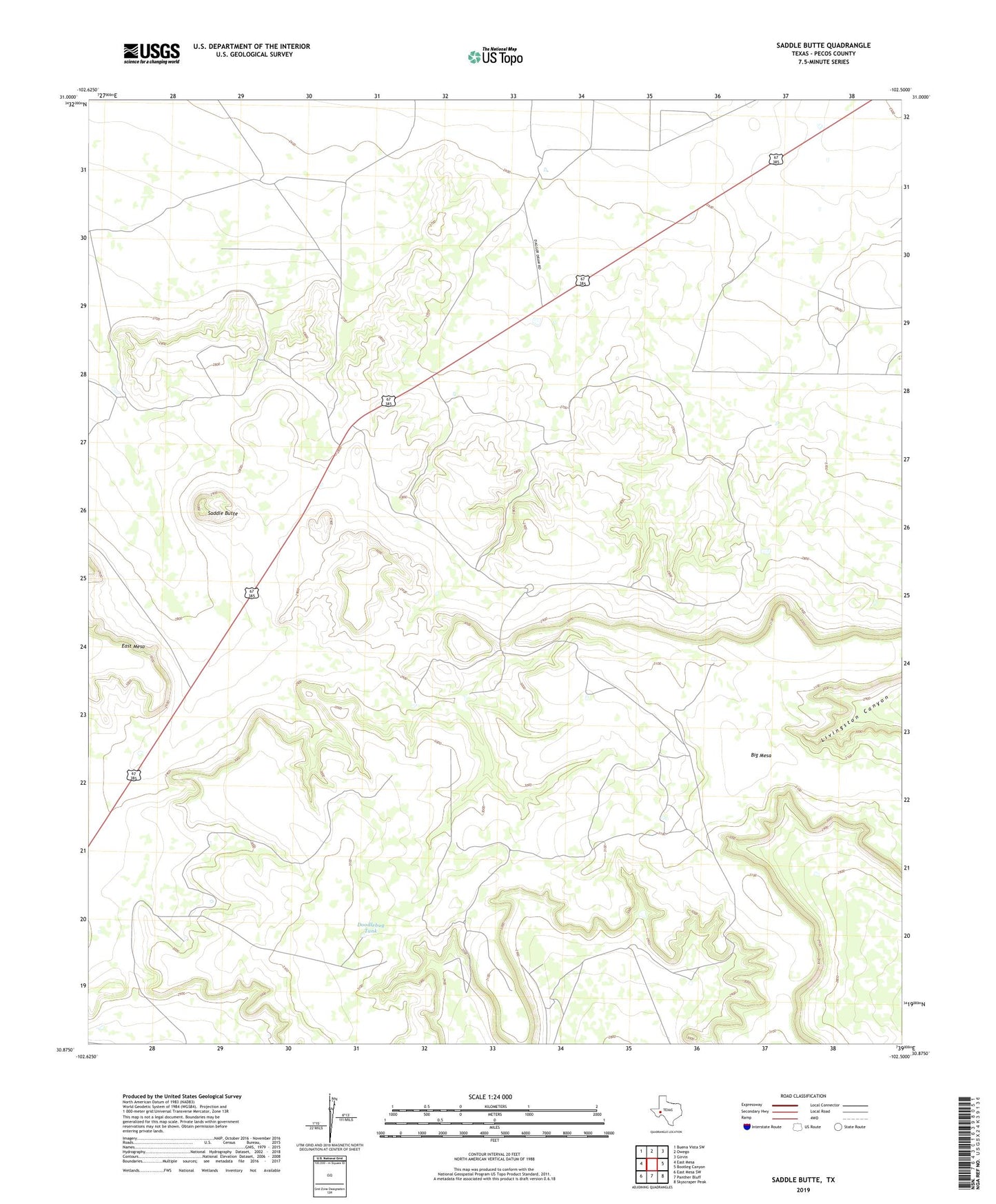
2022 topographic map quadrangle Saddle Butte in the state of Texas. Scale: 1:24000. Based on the newly updated USGS 7.5' US Topo map series, this map is in the following counties: Pecos. The map contains contour data, water features, and other items you are used to seeing on USGS maps, but also has updated roads and other features. This is the next generation of topographic maps. Printed on high-quality waterproof paper with UV fade-resistant inks.
Quads adjacent to this one:
West: East Mesa
Northwest: Buena Vista SW
North: Owego
Northeast: Girvin
East: Bootleg Canyon
Southeast: Skyscraper Peak
South: Panther Bluff
Southwest: East Mesa SW
This map covers the same area as the classic USGS quad with code o30102h5.
Contains the following named places: Big Mesa, Canyon Windmill, Divide Windmill, Doodlebug Tank, Doodlebug Windmill, East Windmill, Highway Windmill, North Windmill, Old Headquarters Windmill, Saddle Butte, West Windmill, Windmill Number Three