MyTopo
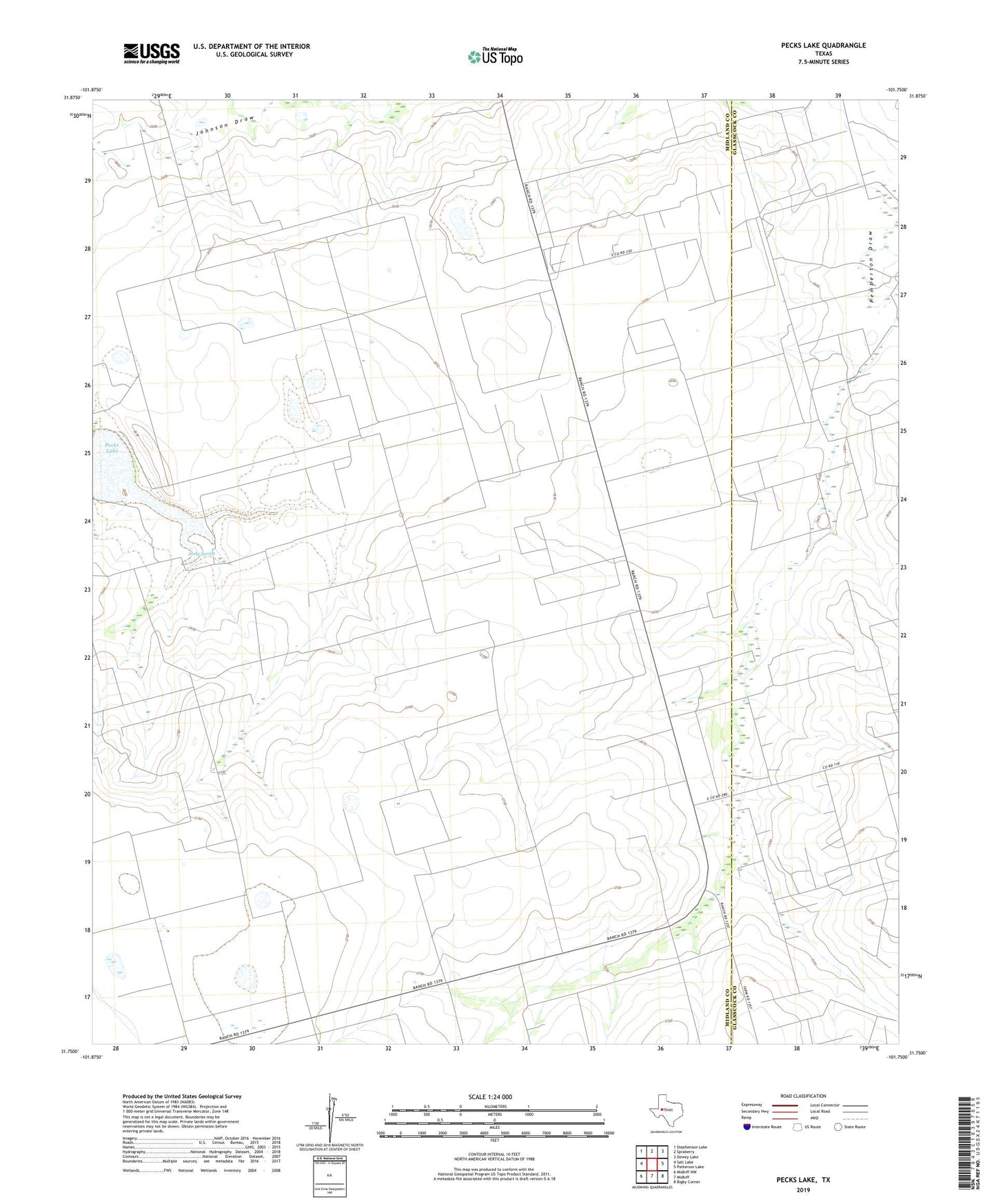
Pecks Lake Texas US Topo Map
Couldn't load pickup availability
2022 topographic map quadrangle Pecks Lake in the state of Texas. Scale: 1:24000. Based on the newly updated USGS 7.5' US Topo map series, this map is in the following counties: Midland, Glasscock. The map contains contour data, water features, and other items you are used to seeing on USGS maps, but also has updated roads and other features. This is the next generation of topographic maps. Printed on high-quality waterproof paper with UV fade-resistant inks.
Quads adjacent to this one:
West: Salt Lake
Northwest: Stephenson Lake
North: Spraberry
Northeast: Dewey Lake
East: Patterson Lake
Southeast: Bigby Corner
South: Midkiff
Southwest: Midkiff NW
This map covers the same area as the classic USGS quad with code o31101g7.
Contains the following named places: Brown Windmill, East Windmill, Farm Windmill, Hi Lonesome Windmill, Hill Windmill, Lake Windmill, Last Chance Windmill, Middle Windmill, North Pasture Windmill, Pecks Lake, Pecks Spring, Pioneer Memorial Church, Shackleford Windmill, South Windmill, Spraberry Gas Plant, Steel Trap Windmill, Thirtyeight Windmill, Tucker Windmill, Weatherd Windmill, Wrage Windmill