MyTopo
Sand Mountain Texas US Topo Map
Couldn't load pickup availability
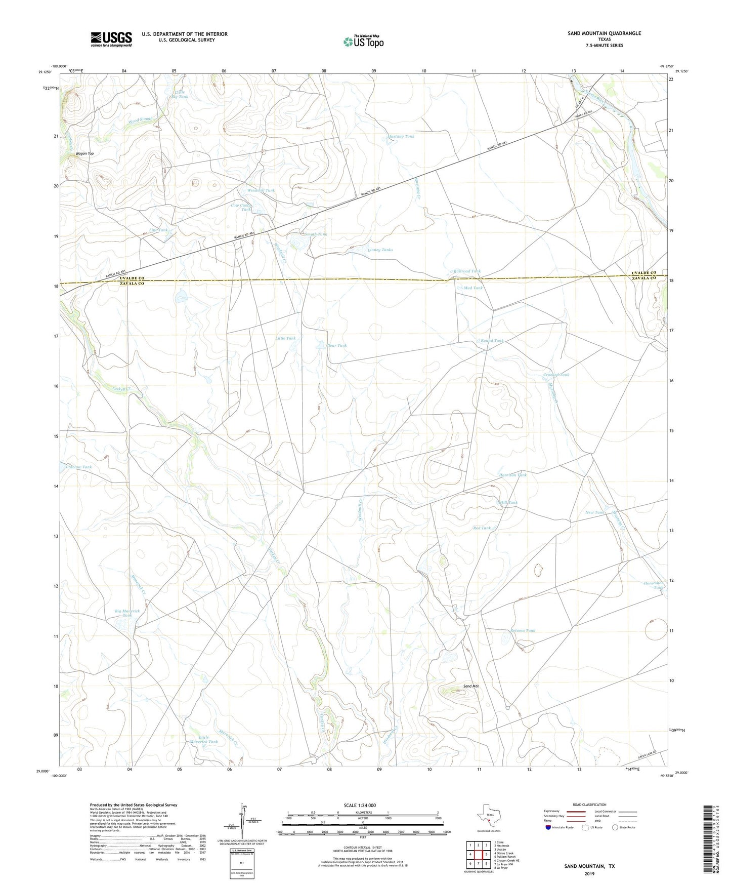
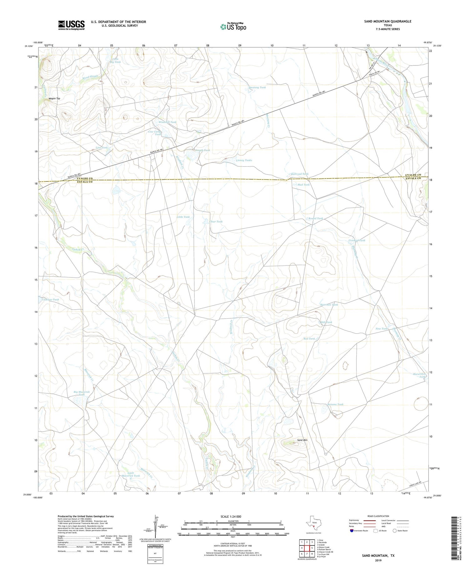
2019 topographic map quadrangle Sand Mountain in the state of Texas. Scale: 1:24000. Based on the newly updated USGS 7.5' US Topo map series, this map is in the following counties: Zavala, Uvalde. The map contains contour data, water features, and other items you are used to seeing on USGS maps, but also has updated roads and other features. This is the next generation of topographic maps. Printed on high-quality waterproof paper with UV fade-resistant inks.
Quads adjacent to this one:
West: Olmos Creek
Northwest: Cline
North: Hacienda
Northeast: Uvalde
East: Pulliam Ranch
Southeast: La Pryor
South: La Pryor NW
Southwest: Chacon Creek NE
Contains the following named places: Anthon Ranch, Barkly Ranch, Big Maverick Lake Dam, Big Maverick Tank, Catclaw Tank, Clear Tank, Cow Camp Tank, Crooked Tank, Harrison Tank, Hill Tank, Kieffer Windmill, Line Tank, Linney Tanks, Little Big Tank, Little Maverick Tank, Little Tank, Lyles Ranch, Mud Tank, Mustang Tank, New Tank, North Windmill, Railroad Tank, Red Tank, Retama Tank, Round Tank, Sand Mountain, Smith Dam, Smyth Crossing, Smyth Lake Dam, Smyth Station, Smyth Tank, Stub Windmill, Wagon Top, Weirbush Ranch, West Windmill, Windmill Tank, Wood Slough