MyTopo
Olmos Creek Texas US Topo Map
Couldn't load pickup availability
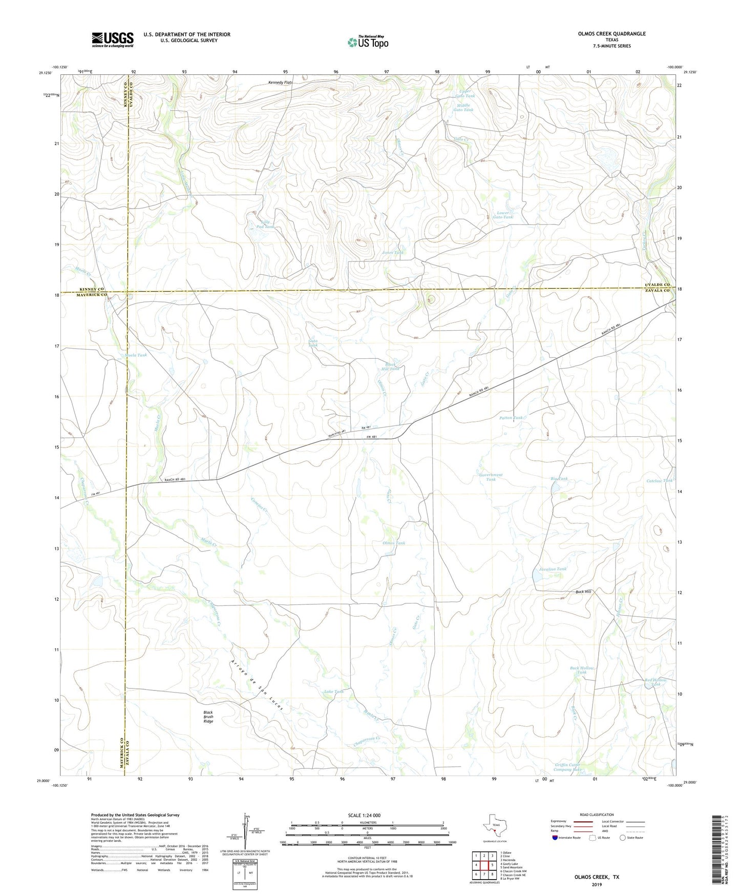
2022 topographic map quadrangle Olmos Creek in the state of Texas. Scale: 1:24000. Based on the newly updated USGS 7.5' US Topo map series, this map is in the following counties: Zavala, Uvalde, Maverick, Kinney. The map contains contour data, water features, and other items you are used to seeing on USGS maps, but also has updated roads and other features. This is the next generation of topographic maps. Printed on high-quality waterproof paper with UV fade-resistant inks.
Quads adjacent to this one:
West: Goofy Lake
Northwest: Odlaw
North: Cline
Northeast: Hacienda
East: Sand Mountain
Southeast: La Pryor NW
South: Chacon Creek NE
Southwest: Chacon Creek NW
This map covers the same area as the classic USGS quad with code o29100a1.
Contains the following named places: Big Tank, Black Brush Ridge, Black Hill Tank, Buck Creek, Buck Hill, Buck Hollow Tank, Conejos Creek, Gato Creek, Gato Tank, Government Tank, Javalina Tank, Jones Tank, Lake Tank, Lilly Pad Tank, Little Muela Creek, Lower Gato Tank, Middle Gato Tank, Muela Creek, Muela Tank, Muela Well, Olmos Creek, Olmos Tank, Patton Tank, Red Hollow Tank, Rock Dam, Upper Gato Tank, Watkins Lake Number 1 Dam