MyTopo
Hacienda Texas US Topo Map
Couldn't load pickup availability
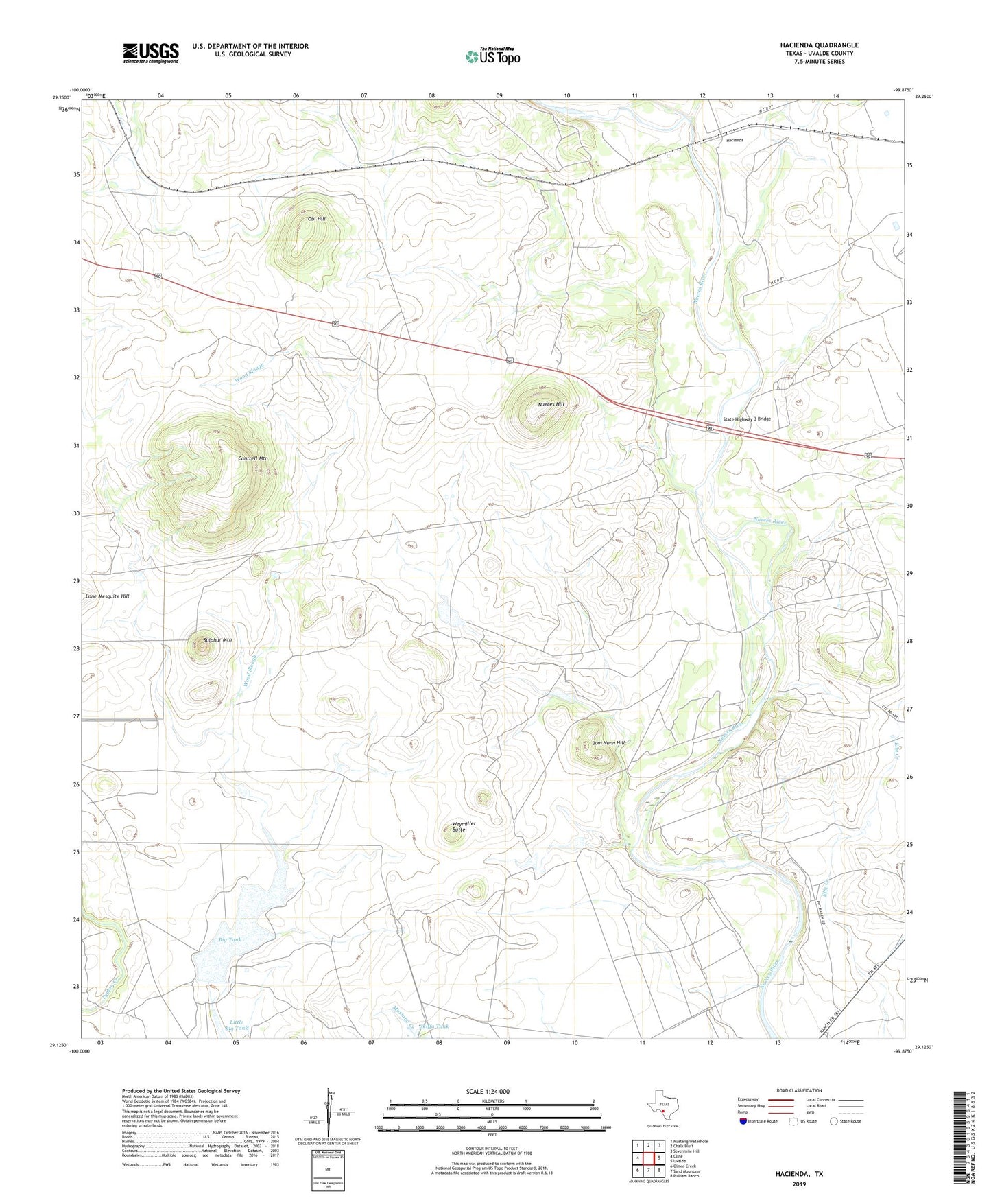
2022 topographic map quadrangle Hacienda in the state of Texas. Scale: 1:24000. Based on the newly updated USGS 7.5' US Topo map series, this map is in the following counties: Uvalde. The map contains contour data, water features, and other items you are used to seeing on USGS maps, but also has updated roads and other features. This is the next generation of topographic maps. Printed on high-quality waterproof paper with UV fade-resistant inks.
Quads adjacent to this one:
West: Cline
Northwest: Mustang Waterhole
North: Chalk Bluff
Northeast: Sevenmile Hill
East: Uvalde
Southeast: Pulliam Ranch
South: Sand Mountain
Southwest: Olmos Creek
This map covers the same area as the classic USGS quad with code o29099b8.
Contains the following named places: Allen Ranch, Big Tank, Cantrell Mountain, Hacienda, Ingrum Ranch, Miraso Ranch, Nueces Hill, Obi Hill, Rosenow Ranch, Skiffa Tank, Smyth Dam, Smythe Ranch, Soldiers Camp Springs, State Highway 3 Bridge, Sulphur Mountain, Thompson Tank Dam, Thompson Tank Reservoir, Tom Nunn Hill, United States Border Patrol Checkpoint, Weymiller Butte