MyTopo
La Pryor NW Texas US Topo Map
Couldn't load pickup availability
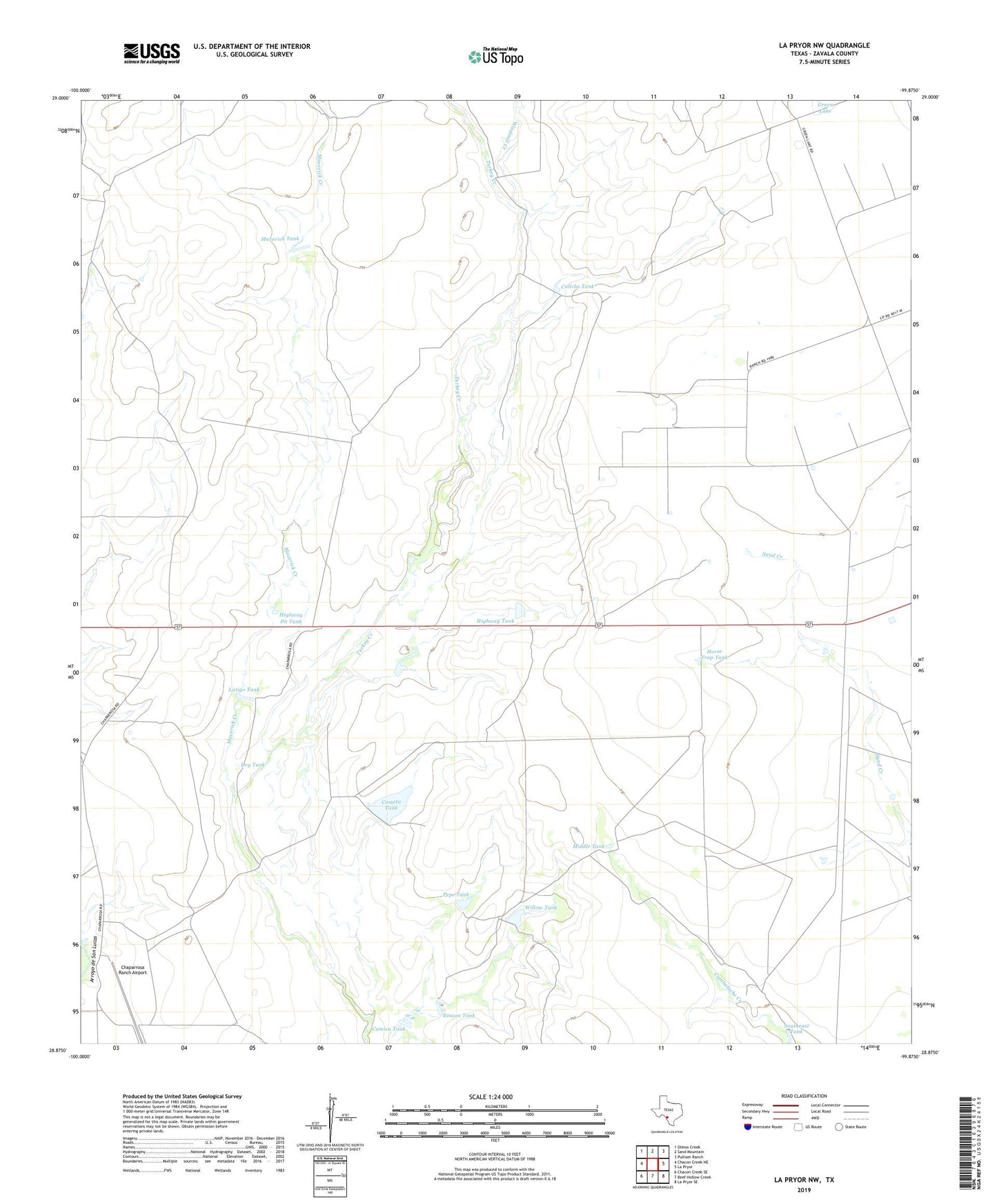
2022 topographic map quadrangle La Pryor NW in the state of Texas. Scale: 1:24000. Based on the newly updated USGS 7.5' US Topo map series, this map is in the following counties: Zavala. The map contains contour data, water features, and other items you are used to seeing on USGS maps, but also has updated roads and other features. This is the next generation of topographic maps. Printed on high-quality waterproof paper with UV fade-resistant inks.
Quads adjacent to this one:
West: Chacon Creek NE
Northwest: Olmos Creek
North: Sand Mountain
Northeast: Pulliam Ranch
East: La Pryor
Southeast: La Pryor SE
South: Beef Hollow Creek
Southwest: Chacon Creek SE
This map covers the same area as the classic USGS quad with code o28099h8.
Contains the following named places: Alto Colorado Well, Bowles Windmill, Caballos Windmill, Caliche Tank, Camisa Tank, Chaparrosa Lake, Chaparrosa Lake Dam, Chaparrosa Ranch, Chaparrosa Ranch Airport, Cometa Tank, Comstock Windmill, Dawson Windmill, Dry Tank, Fourmile Windmill, Green Lake, Hensley Windmill, Highway Pit Tank, Highway Tank, Horse Trap Tank, Kite Windmill, La Pryor Division, Lake Windmill, Latigo Tank, Maverick Creek, Maverick Creek Windmill, Maverick Tank, Middle Tank, Oliphant Ranch, Pepe Tank, Rancho Viejo Windmill, Rincon Tank, Sevenmile Windmill, Turkey Creek Windmill, Watkins Lake Number 2, Watkins Lake Number 2 Dam, Willow Tank, Willow Tank Dam, Windmill Creek