MyTopo
Pulliam Ranch Texas US Topo Map
Couldn't load pickup availability
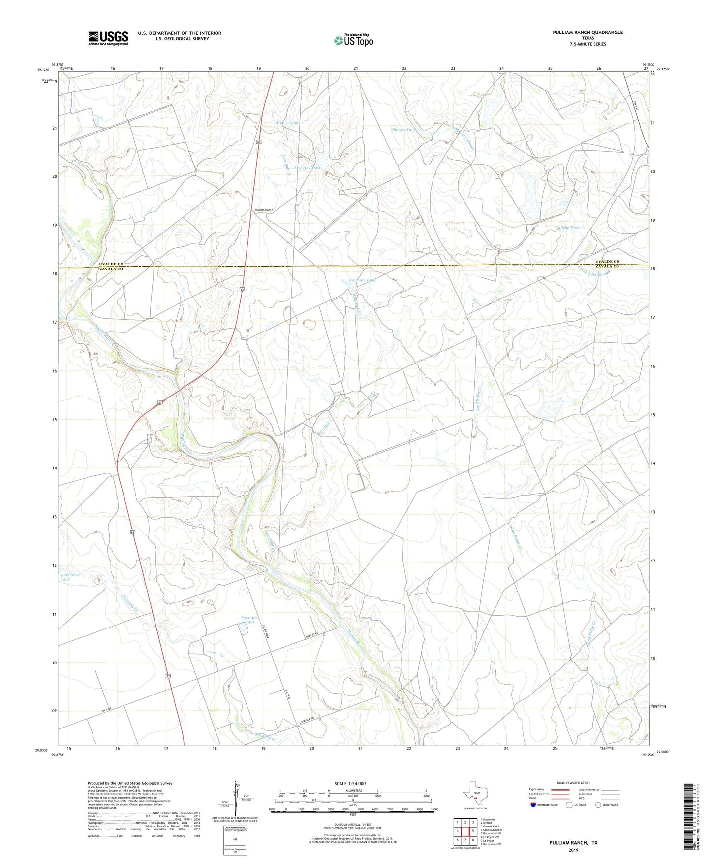
2022 topographic map quadrangle Pulliam Ranch in the state of Texas. Scale: 1:24000. Based on the newly updated USGS 7.5' US Topo map series, this map is in the following counties: Zavala, Uvalde. The map contains contour data, water features, and other items you are used to seeing on USGS maps, but also has updated roads and other features. This is the next generation of topographic maps. Printed on high-quality waterproof paper with UV fade-resistant inks.
Quads adjacent to this one:
West: Sand Mountain
Northwest: Hacienda
North: Uvalde
Northeast: Garner Field
East: Batesville Hill
Southeast: Batesville NW
South: La Pryor
Southwest: La Pryor NW
This map covers the same area as the classic USGS quad with code o29099a7.
Contains the following named places: A B Junction, Buckley Well, Cain Lake, Cain Lake Dam, Cain Ranch, Caliche Tank, Crooked Well, Elm Creek, Four Acre Tank, Horseshoe Tank, Kennedy Tank, Kennedy Windmill, Live Oak Creek, Live Oak Tank, Lyles Ranch, Ninemile Tank, Palmer Dam, Palmer Ranch, Palmer Tank, Palmer Tank Dam, Peterson Lake, Peterson Lake Dam, Pulliam Ranch, Ranger Tank, Sand Hill Well, Uvalde Test Track, Washer, Willow Tank