MyTopo
Afton Texas US Topo Map
Couldn't load pickup availability
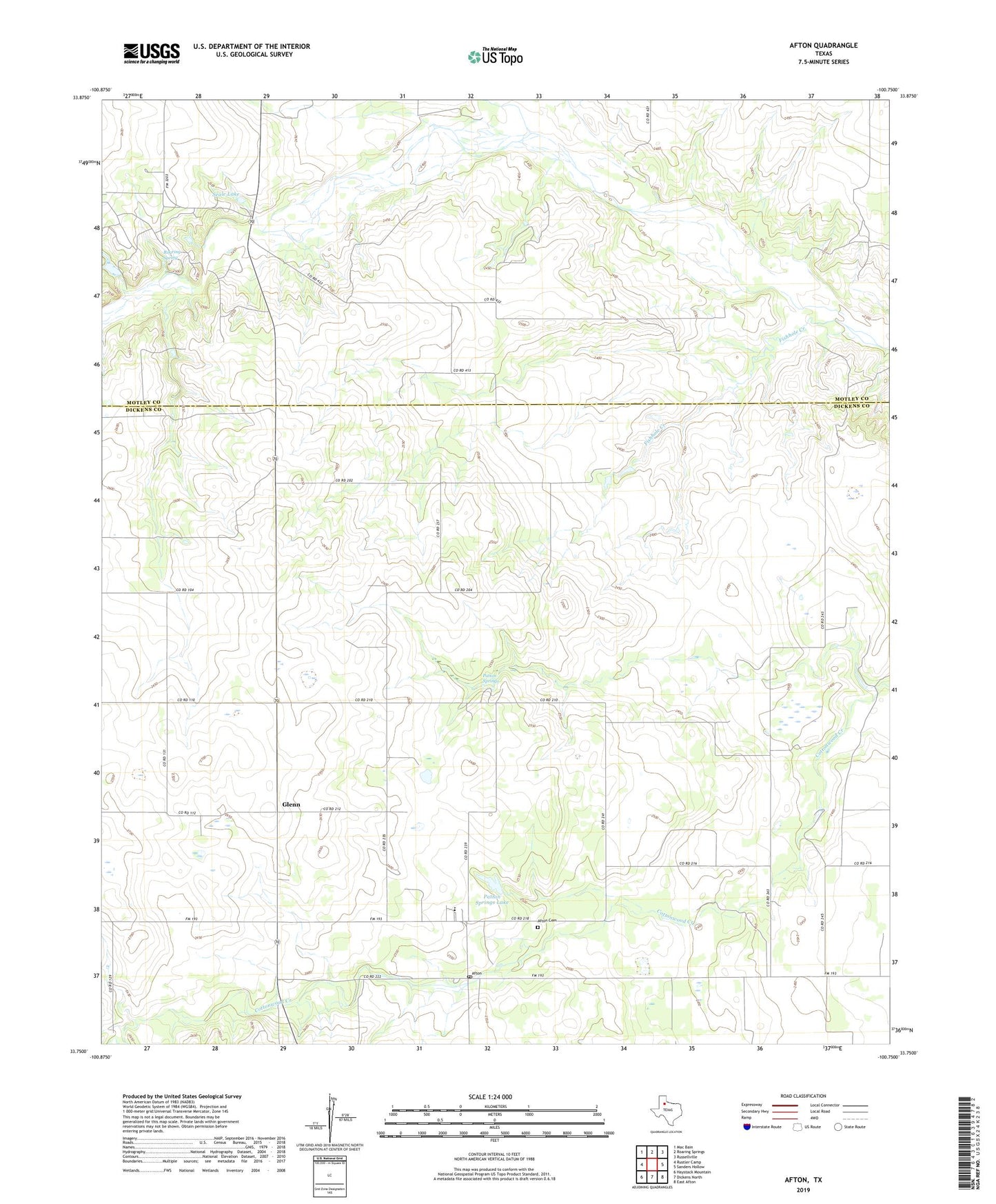
2022 topographic map quadrangle Afton in the state of Texas. Scale: 1:24000. Based on the newly updated USGS 7.5' US Topo map series, this map is in the following counties: Dickens, Motley. The map contains contour data, water features, and other items you are used to seeing on USGS maps, but also has updated roads and other features. This is the next generation of topographic maps. Printed on high-quality waterproof paper with UV fade-resistant inks.
Quads adjacent to this one:
West: Rustler Camp
Northwest: Mac Bain
North: Roaring Springs
Northeast: Russellville
East: Sanders Hollow
Southeast: East Afton
South: Dickens North
Southwest: Haystack Mountain
This map covers the same area as the classic USGS quad with code o33100g7.
Contains the following named places: Afton, Afton Cemetery, Afton Post Office, Dutchman Creek, Fishhole Creek, Glenn, Lucretia Campbell Dam, Patton Springs, Patton Springs Lake, Patton Springs School, Roaring Spring, Seale Lake, Seale Lake Dam, ZIP Code: 79220