MyTopo
Schott Mountain Texas US Topo Map
Couldn't load pickup availability
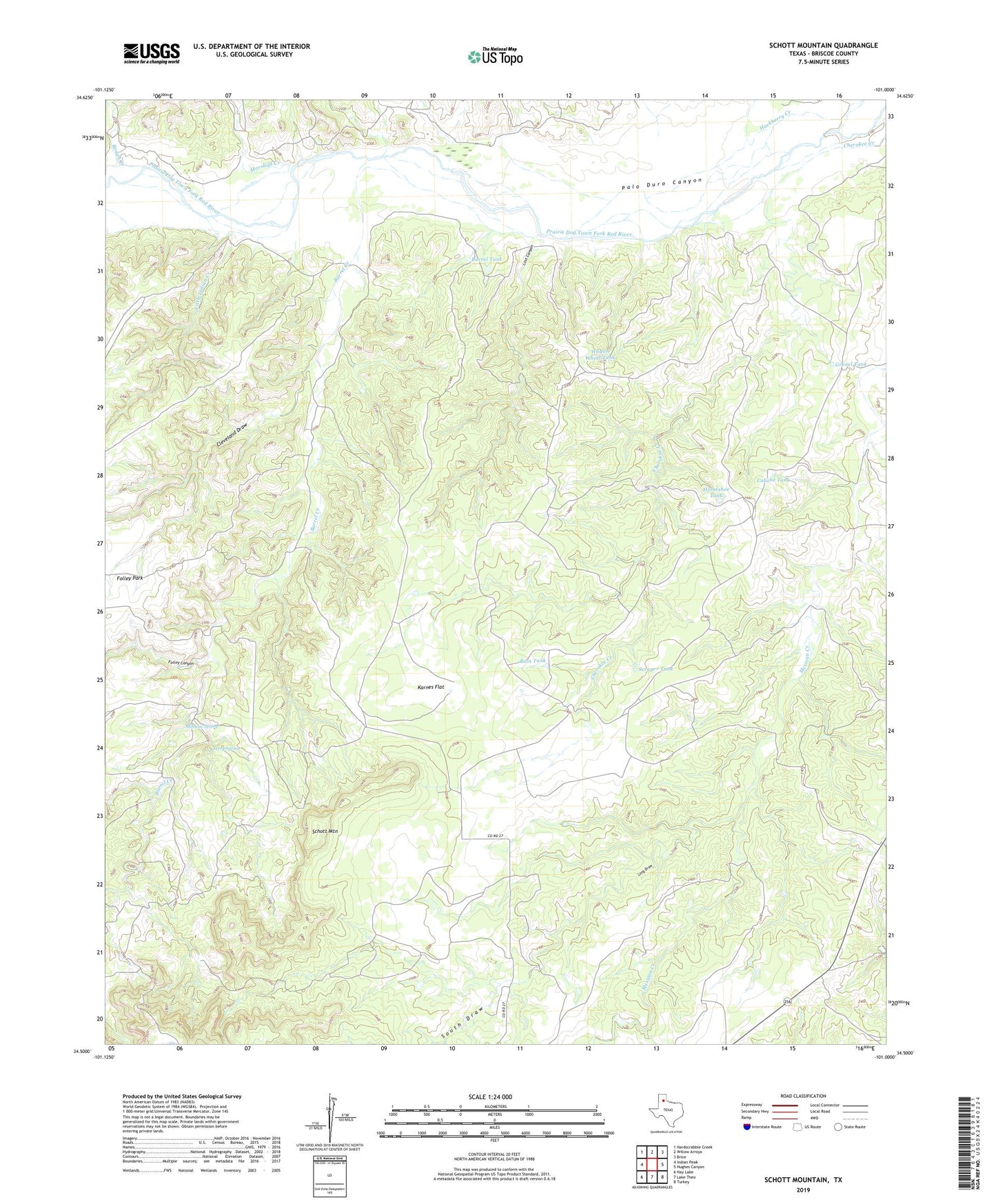
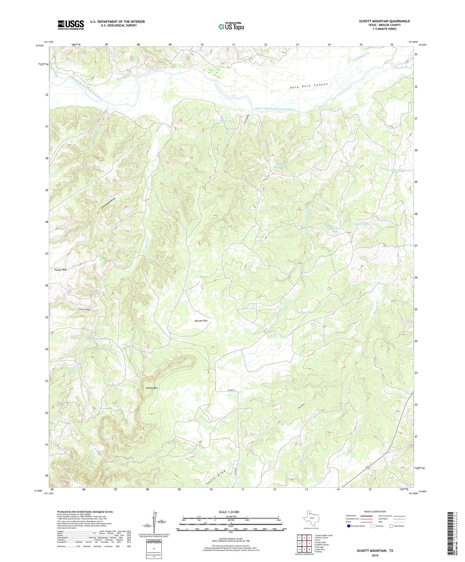
2019 topographic map quadrangle Schott Mountain in the state of Texas. Scale: 1:24000. Based on the newly updated USGS 7.5' US Topo map series, this map is in the following counties: Briscoe. The map contains contour data, water features, and other items you are used to seeing on USGS maps, but also has updated roads and other features. This is the next generation of topographic maps. Printed on high-quality waterproof paper with UV fade-resistant inks.
Quads adjacent to this one:
West: Indian Peak
Northwest: Hardscrabble Creek
North: Willow Arroyo
Northeast: Brice
East: Hughes Canyon
Southeast: Turkey
South: Lake Theo
Southwest: Hay Lake
Contains the following named places: Barrel Creek, Barrel Tank, Bass Tank, Caliche Tank, Cherokee Camp, Cherokee Creek, Cleveland Draw, Folley Canyon, Gravel Tank, Hackberry Creek, Heckman Camp, Horseshoe Tank, Karnes Flat, Little Indian Creek, Long Draw, Lost Canyon, Lower Barrel Camp, Marshall Creek, Minnow Spring, Rincon School, Rough Creek, Schott Mountain, Schott Ranch, Scraper Tank, South Draw, Stinkhole Windmill, Terry Spring, Wagon Wheel Tank