MyTopo
Scotland Texas US Topo Map
Couldn't load pickup availability
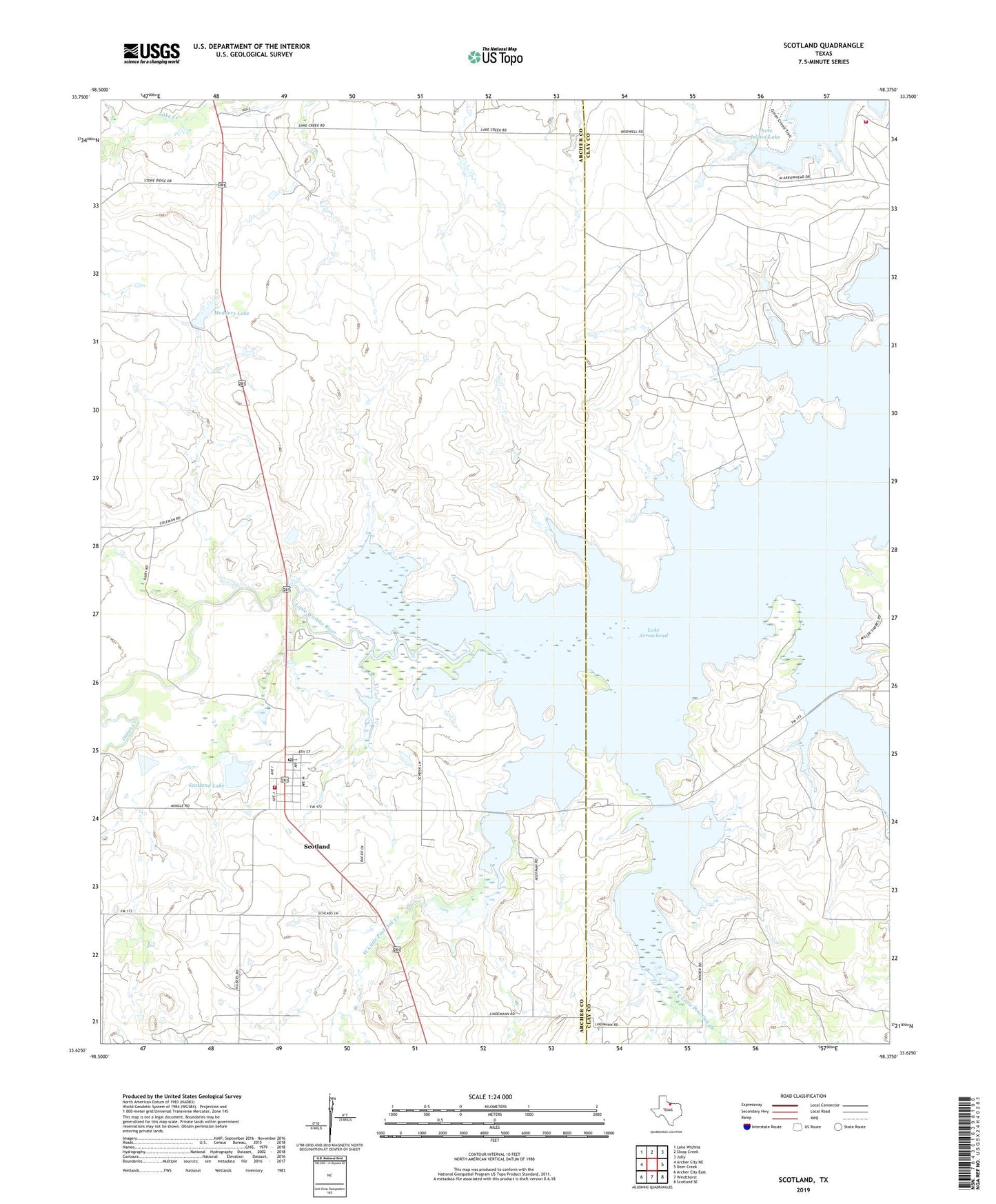
2019 topographic map quadrangle Scotland in the state of Texas. Scale: 1:24000. Based on the newly updated USGS 7.5' US Topo map series, this map is in the following counties: Archer, Clay. The map contains contour data, water features, and other items you are used to seeing on USGS maps, but also has updated roads and other features. This is the next generation of topographic maps. Printed on high-quality waterproof paper with UV fade-resistant inks.
Quads adjacent to this one:
West: Archer City NE
Northwest: Lake Wichita
North: Sloop Creek
Northeast: Jolly
East: Deer Creek
Southeast: Scotland SE
South: Windthorst
Southwest: Archer City East
Contains the following named places: Big Tree Park, Birdwell Ranch, BRR Oil Field, City of Scotland, Clay County Regular Oil Field, Deer Creek, Deer Creek Park, East Little Post Oak Creek, Horseshoe Bend, Lake Arrowhead, Lake Arrowhead Volunteer Fire Department Station A, Lake Creek Church, Little Post Oak Creek, Little Post Oak Creek Park, Marsh Park, Medders Lake, Medders Lake Dam, Scotland, Scotland Lake, Scotland Lake Dam, Scotland Post Office, Scotland Volunteer Fire Department, Southvogtsberger-Strawn Oil Field, Three Island Lake, Three Island Lake Dam, West Little Post Oak Creek, ZIP Code: 76379