MyTopo
Jolly Texas US Topo Map
Couldn't load pickup availability
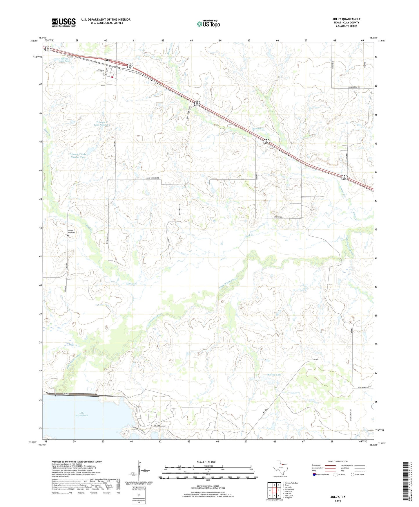
2022 topographic map quadrangle Jolly in the state of Texas. Scale: 1:24000. Based on the newly updated USGS 7.5' US Topo map series, this map is in the following counties: Clay. The map contains contour data, water features, and other items you are used to seeing on USGS maps, but also has updated roads and other features. This is the next generation of topographic maps. Printed on high-quality waterproof paper with UV fade-resistant inks.
Quads adjacent to this one:
West: Sloop Creek
Northwest: Wichita Falls East
North: Dean
Northeast: Hurnville
East: Henrietta
Southeast: Bluegrove
South: Deer Creek
Southwest: Scotland
This map covers the same area as the classic USGS quad with code o33098g3.
Contains the following named places: Bennett Creek, Crow Trace Park, Crow Trace Point Park, Delaware Trail Park, Duck Creek, Halsell Lake Dam, Jolly, Jollyville Volunteer Fire Department, Lake Creek, North Park, School Land Lake, School Land Lake Dam, Triangle T Cattle Company Lake Dam, Triangle T Lake Number 1, Triangle T Lake Number 1 Dam, Triangle T Lake Number 2 Dam, Triangle T Lake Number Two, White Hill Cemetery, Whitley Lake, Whitley Lake Dam, Wichita Falls Dam