MyTopo
Sloop Creek Texas US Topo Map
Couldn't load pickup availability
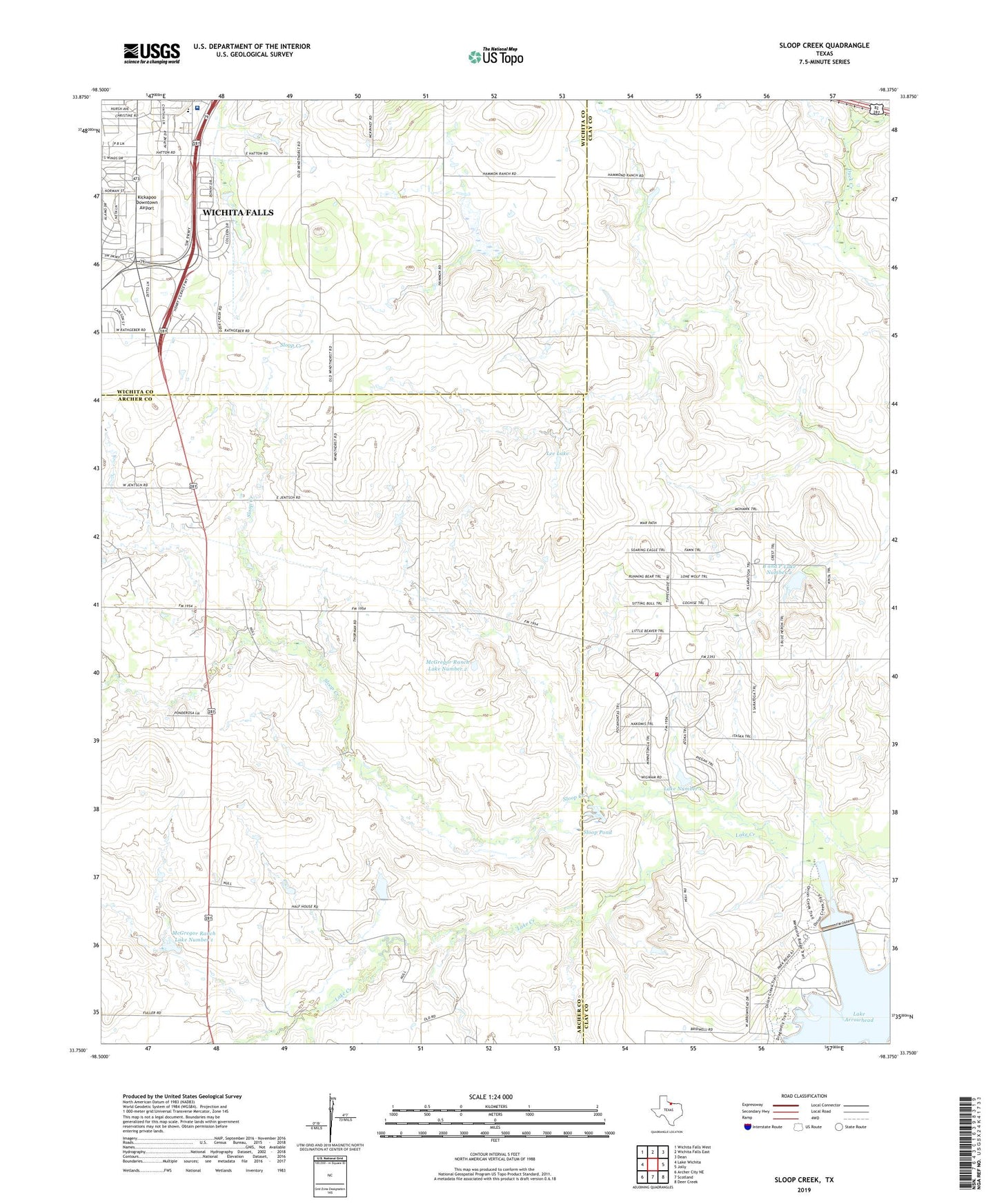
2022 topographic map quadrangle Sloop Creek in the state of Texas. Scale: 1:24000. Based on the newly updated USGS 7.5' US Topo map series, this map is in the following counties: Archer, Clay, Wichita. The map contains contour data, water features, and other items you are used to seeing on USGS maps, but also has updated roads and other features. This is the next generation of topographic maps. Printed on high-quality waterproof paper with UV fade-resistant inks.
Quads adjacent to this one:
West: Lake Wichita
Northwest: Wichita Falls West
North: Wichita Falls East
Northeast: Dean
East: Jolly
Southeast: Deer Creek
South: Scotland
Southwest: Archer City NE
This map covers the same area as the classic USGS quad with code o33098g4.
Contains the following named places: Arrowhead Ranch Estates Volunteer Fire Department, Avis Ranch, B and P Lake Number 1 Dam, B and P Lake Number 2, B and P Lake Number 2 Dam, Cook Ranch, Fain Elementary School, Healthsouth Rehabilitation Hospital of Wichita Falls, Hursh Park, Jentsch Ranch, Keith Ranch, Kickapoo Downtown Airport, Lake Arrowhead Dam, Lake Arrowhead State Park, Lake Arrowhead State Park Trail, Lake Number 1, Lee Lake, Lee Lake Dam, Loch Lomond Park, McGregor Ranch, McGregor Ranch Lake Number 1, McGregor Ranch Lake Number 1 Dam, McGregor Ranch Lake Number 2, McGregor Ranch Lake Number 2 Dam, Norris Ranch, North Star School, Rathgeber Ranch, Sloop Creek, Sloop Pond, Southern Hills Park, Texas No Name Number 41 Dam, Trinity Baptist Church, Vogtsberger Oil Field, Vogtsberger Ranch, Wesley United Methodist Church, ZIP Code: 76302